
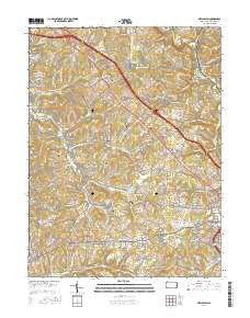
~ New Salem PA topo map, 1:24000 scale, 7.5 X 7.5 Minute, 2016
New Salem, Pennsylvania, USGS topographic map dated 2016.
Includes geographic coordinates (latitude and longitude). This topographic map is suitable for hiking, camping, and exploring, or framing it as a wall map.
Printed on-demand using high resolution imagery, on heavy weight and acid free paper, or alternatively on a variety of synthetic materials.
Topos available on paper, Waterproof, Poly, or Tyvek. Usually shipping rolled, unless combined with other folded maps in one order.
- Product Number: USGS-8247988
- Free digital map download (high-resolution, GeoPDF): New Salem, Pennsylvania (file size: 27 MB)
- Map Size: please refer to the dimensions of the GeoPDF map above
- Weight (paper map): ca. 55 grams
- Map Type: POD USGS Topographic Map
- Map Series: US Topo
- Map Verison: Current
- Cell ID: 31848
- Datum: North American Datum of 1983
- Map Projection: Transverse Mercator
- Map Cell Name: New Salem
- Grid size: 7.5 X 7.5 Minute
- Date on map: 2016
- Map Scale: 1:24000
- Geographical region: Pennsylvania, United States
Neighboring Maps:
All neighboring USGS topo maps are available for sale online at a variety of scales.
Spatial coverage:
Topo map New Salem, Pennsylvania, covers the geographical area associated the following places:
- Orient - Messmore - Herbert - Balsinger - Lower Peanut - Continental Number 2 - Upper Peanut - Uledi - Clayford - Fairbank - Allison - Rothruck - Chestnut Ridge - Shamrock - Helen - Keisterville - Rocks Works - Lambert - Davidson - Dunlap Creek Village - Sea Right - Hoover - Brier Hill - Hays - Newboro - Jefferis - Upper Middletown - Buffington - Footedale - New Salem - Sandy Hill (historical) - Tuckertown - Dearth - Newcomer - Searights - Waltersburg - Smock - McClellandtown - Puritan - Cardale - Filbert - Haddenville
- Map Area ID: AREA4039.875-79.875-79.75
- Northwest corner Lat/Long code: USGSNW40-79.875
- Northeast corner Lat/Long code: USGSNE40-79.75
- Southwest corner Lat/Long code: USGSSW39.875-79.875
- Southeast corner Lat/Long code: USGSSE39.875-79.75
- Northern map edge Latitude: 40
- Southern map edge Latitude: 39.875
- Western map edge Longitude: -79.875
- Eastern map edge Longitude: -79.75


