
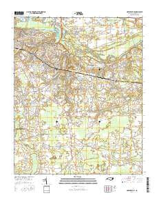
~ Greenville SE NC topo map, 1:24000 scale, 7.5 X 7.5 Minute, 2016
Greenville SE, North Carolina, USGS topographic map dated 2016.
Includes geographic coordinates (latitude and longitude). This topographic map is suitable for hiking, camping, and exploring, or framing it as a wall map.
Printed on-demand using high resolution imagery, on heavy weight and acid free paper, or alternatively on a variety of synthetic materials.
Topos available on paper, Waterproof, Poly, or Tyvek. Usually shipping rolled, unless combined with other folded maps in one order.
- Product Number: USGS-8240444
- Free digital map download (high-resolution, GeoPDF): Greenville SE, North Carolina (file size: 26 MB)
- Map Size: please refer to the dimensions of the GeoPDF map above
- Weight (paper map): ca. 55 grams
- Map Type: POD USGS Topographic Map
- Map Series: US Topo
- Map Verison: Current
- Cell ID: 18466
- Datum: North American Datum of 1983
- Map Projection: Transverse Mercator
- Map Cell Name: Greenville SE
- Grid size: 7.5 X 7.5 Minute
- Date on map: 2016
- Map Scale: 1:24000
- Geographical region: North Carolina, United States
Neighboring Maps:
All neighboring USGS topo maps are available for sale online at a variety of scales.
Spatial coverage:
Topo map Greenville SE, North Carolina, covers the geographical area associated the following places:
- Greenville - Green Springs - McGowans Crossroads - Bell Fork - Golden Place - Brittany Ridge - Evans Trailer Park - College Court - Stratford - New Belden - Rolling Meadows - Hollywood Crossroads - Paramore Farm - Hardee Acres - Highland Mobile Home Park - Worthingtons Crossroads - Highland Mobile Home Park - Alvah Hardy Jr Mobile Home Park - Dellwood - Cox Crossing - Quail Ridge - Oakmont - Scarborough - College View - Johnston Heights - Gold Leaf Estates - Baytree - Tucker Estates - Englewood - Planters Walk - Eastwood - Rock Springs - Twin Creek - Windy Ridge - Ripple City - Heritage Village - Edwards Acres - Hills Estate Mobile Home Park - Drexelbrook - Galloway Crossroads - Brook Valley - Cherry Oaks - River Hills - Forest Hills - Wilson Acres - Easthaven - Coghill - Galloway Farms - Arbor Hills - Brook Green - Camelot - Oakhurst - Sheraton Place - Tuckahoe - Evans Mobile Home Park - Jacksons Trailer Park - Hartington and Williams - Hudsons Crossroads - Lake Glenwood - Chatham Circle - Azalea Gardens Mobile Home Park - Greystone Mobile Home Park - Speight - Windsor - Simpson - Sherwood Greens - Wintergreen Mobile Home Park
- Map Area ID: AREA35.62535.5-77.375-77.25
- Northwest corner Lat/Long code: USGSNW35.625-77.375
- Northeast corner Lat/Long code: USGSNE35.625-77.25
- Southwest corner Lat/Long code: USGSSW35.5-77.375
- Southeast corner Lat/Long code: USGSSE35.5-77.25
- Northern map edge Latitude: 35.625
- Southern map edge Latitude: 35.5
- Western map edge Longitude: -77.375
- Eastern map edge Longitude: -77.25


