
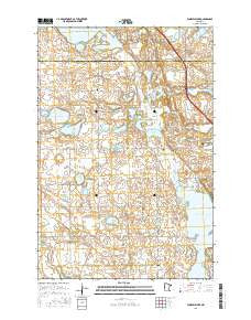
~ Fourmile Lake MN topo map, 1:24000 scale, 7.5 X 7.5 Minute, 2016
Fourmile Lake, Minnesota, USGS topographic map dated 2016.
Includes geographic coordinates (latitude and longitude). This topographic map is suitable for hiking, camping, and exploring, or framing it as a wall map.
Printed on-demand using high resolution imagery, on heavy weight and acid free paper, or alternatively on a variety of synthetic materials.
Topos available on paper, Waterproof, Poly, or Tyvek. Usually shipping rolled, unless combined with other folded maps in one order.
- Product Number: USGS-8227452
- Free digital map download (high-resolution, GeoPDF): Fourmile Lake, Minnesota (file size: 22 MB)
- Map Size: please refer to the dimensions of the GeoPDF map above
- Weight (paper map): ca. 55 grams
- Map Type: POD USGS Topographic Map
- Map Series: US Topo
- Map Verison: Current
- Cell ID: 16147
- Datum: North American Datum of 1983
- Map Projection: Transverse Mercator
- Map Cell Name: Fourmile Lake
- Grid size: 7.5 X 7.5 Minute
- Date on map: 2016
- Map Scale: 1:24000
- Geographical region: Minnesota, United States
Neighboring Maps:
All neighboring USGS topo maps are available for sale online at a variety of scales.
Spatial coverage:
Topo map Fourmile Lake, Minnesota, covers the geographical area associated the following places:
- School Number 38 (historical) - School Number 11 (historical) - Bethlehem Lutheran Church - Tipsinah Mound Golf Course - Pelican Creek - Hagen Lake - Beebe Lake - Skunk Lake - Christ Cemetery - Bethlehem Cemetery - Ten Mile Lake Dam - School Number 55 (historical) - Field Lake - Township of Pomme de Terre - School Number 15 (historical) - Hjerdal Cemetery - Scott Lake - Briggs Lake - Burns Cemetery - Grinder Lake - Pomme de Terre Lake - School Number 37 (historical) - Pomme de Terre Cemetery - Horseshoe Lake - Larson Lake - Fourmile Lake - School Number 63 (historical) - Mill Pond
- Map Area ID: AREA46.12546-96-95.875
- Northwest corner Lat/Long code: USGSNW46.125-96
- Northeast corner Lat/Long code: USGSNE46.125-95.875
- Southwest corner Lat/Long code: USGSSW46-96
- Southeast corner Lat/Long code: USGSSE46-95.875
- Northern map edge Latitude: 46.125
- Southern map edge Latitude: 46
- Western map edge Longitude: -96
- Eastern map edge Longitude: -95.875


