
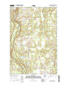
~ Sandstone South MN topo map, 1:24000 scale, 7.5 X 7.5 Minute, 2016
Sandstone South, Minnesota, USGS topographic map dated 2016.
Includes geographic coordinates (latitude and longitude). This topographic map is suitable for hiking, camping, and exploring, or framing it as a wall map.
Printed on-demand using high resolution imagery, on heavy weight and acid free paper, or alternatively on a variety of synthetic materials.
Topos available on paper, Waterproof, Poly, or Tyvek. Usually shipping rolled, unless combined with other folded maps in one order.
- Product Number: USGS-8124146
- Free digital map download (high-resolution, GeoPDF): Sandstone South, Minnesota (file size: 26 MB)
- Map Size: please refer to the dimensions of the GeoPDF map above
- Weight (paper map): ca. 55 grams
- Map Type: POD USGS Topographic Map
- Map Series: US Topo
- Map Verison: Current
- Cell ID: 39824
- Datum: North American Datum of 1983
- Map Projection: Transverse Mercator
- Map Cell Name: Sandstone South
- Grid size: 7.5 X 7.5 Minute
- Date on map: 2016
- Map Scale: 1:24000
- Geographical region: Minnesota, United States
Neighboring Maps:
All neighboring USGS topo maps are available for sale online at a variety of scales.
Spatial coverage:
Topo map Sandstone South, Minnesota, covers the geographical area associated the following places:
- Township of Sandstone - Wilburn Creek - Maple Island - Spring Park Cemetery - Sandstone Rapids - Deer Creek - Kettle River State Wildlife Management Area - Sandstone State Wildlife Management Area - Hinckley Wayside Park - Sandstone National Wildlife Refuge - Federal Correctional Institution Sandstone - Skunk Creek - Big Spring Falls - Spring Creek - Fox Creek - Kettle River Dam - Gateway Family Health Clinic - East Central Senior High School - T Nammacker Dam - Township of Barry - Kettle River Reservoir - Cloverdale School - Grindstone River
- Map Area ID: AREA46.12546-92.875-92.75
- Northwest corner Lat/Long code: USGSNW46.125-92.875
- Northeast corner Lat/Long code: USGSNE46.125-92.75
- Southwest corner Lat/Long code: USGSSW46-92.875
- Southeast corner Lat/Long code: USGSSE46-92.75
- Northern map edge Latitude: 46.125
- Southern map edge Latitude: 46
- Western map edge Longitude: -92.875
- Eastern map edge Longitude: -92.75


