
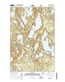
~ Wabana Lake MN topo map, 1:24000 scale, 7.5 X 7.5 Minute, 2016
Wabana Lake, Minnesota, USGS topographic map dated 2016.
Includes geographic coordinates (latitude and longitude). This topographic map is suitable for hiking, camping, and exploring, or framing it as a wall map.
Printed on-demand using high resolution imagery, on heavy weight and acid free paper, or alternatively on a variety of synthetic materials.
Topos available on paper, Waterproof, Poly, or Tyvek. Usually shipping rolled, unless combined with other folded maps in one order.
- Product Number: USGS-8117689
- Free digital map download (high-resolution, GeoPDF): Wabana Lake, Minnesota (file size: 27 MB)
- Map Size: please refer to the dimensions of the GeoPDF map above
- Weight (paper map): ca. 55 grams
- Map Type: POD USGS Topographic Map
- Map Series: US Topo
- Map Verison: Current
- Cell ID: 47064
- Datum: North American Datum of 1983
- Map Projection: Transverse Mercator
- Map Cell Name: Wabana Lake
- Grid size: 7.5 X 7.5 Minute
- Date on map: 2016
- Map Scale: 1:24000
- Geographical region: Minnesota, United States
Neighboring Maps:
All neighboring USGS topo maps are available for sale online at a variety of scales.
Spatial coverage:
Topo map Wabana Lake, Minnesota, covers the geographical area associated the following places:
- Day Lake - Spruce Lake - Little Long Lake - Pickerel Lake - Irma Lake - Pickerel Bay - Sunrise Lake - Pug Hole Lake - Wabana Lake - Bosely Lake - Hill Lake - Snowshoe Lake - Lake Charlotte - Lucky Lake - Lawrence Lake - Little Wolf Lake - Wakeman Bay - Beaver Lake - Little Trout Lake - Lower Spring Lake - Moonshine Lake - Martin - Trout Lake - Roland Lake - Little Bear Lake - Wabana Impoundment - Twin Lake - Bluebill Pond - Simmons Bay - Sand Lake - Long Lake - Dead Horse Lake - Birch Bay - Buckman Cove - Murphy Bay - Bobby Lake - Trout Lake Management Area - Beavertail Lake - Arrowhead Point - Beaver Lake - Francis Lake - Orange Lake - Leoneth Post Office (historical) - Township of Wabana - Buhella Lake - Pug Hole Lake Wayside Park - Bluewater Lake - Bluebill Lake - Spring Lake - Otter Lake - Bee Cee Lake - Wolf Lake - Island Lake - Upper Spring Lake - Spider Lake - Moore Lake - Shelly Lake - Circle Lake - Johnson Lake - Doan Lake
- Map Area ID: AREA47.547.375-93.625-93.5
- Northwest corner Lat/Long code: USGSNW47.5-93.625
- Northeast corner Lat/Long code: USGSNE47.5-93.5
- Southwest corner Lat/Long code: USGSSW47.375-93.625
- Southeast corner Lat/Long code: USGSSE47.375-93.5
- Northern map edge Latitude: 47.5
- Southern map edge Latitude: 47.375
- Western map edge Longitude: -93.625
- Eastern map edge Longitude: -93.5


