
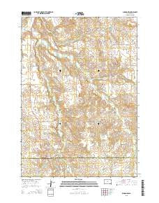
~ Mission NW SD topo map, 1:24000 scale, 7.5 X 7.5 Minute, 2015
Mission NW, South Dakota, USGS topographic map dated 2015.
Includes geographic coordinates (latitude and longitude). This topographic map is suitable for hiking, camping, and exploring, or framing it as a wall map.
Printed on-demand using high resolution imagery, on heavy weight and acid free paper, or alternatively on a variety of synthetic materials.
Topos available on paper, Waterproof, Poly, or Tyvek. Usually shipping rolled, unless combined with other folded maps in one order.
- Product Number: USGS-8012199
- Free digital map download (high-resolution, GeoPDF): Mission NW, South Dakota (file size: 23 MB)
- Map Size: please refer to the dimensions of the GeoPDF map above
- Weight (paper map): ca. 55 grams
- Map Type: POD USGS Topographic Map
- Map Series: US Topo
- Map Verison: Current
- Cell ID: 29632
- Datum: North American Datum of 1983
- Map Projection: Transverse Mercator
- Map Cell Name: Mission NW
- Grid size: 7.5 X 7.5 Minute
- Date on map: 2015
- Map Scale: 1:24000
- Geographical region: South Dakota, United States
Neighboring Maps:
All neighboring USGS topo maps are available for sale online at a variety of scales.
Spatial coverage:
Topo map Mission NW, South Dakota, covers the geographical area associated the following places:
- Neville School - Horse Head Creek - Dolezal John Number 7 Dam - Horse Creek - Body of Christ Cemetery - Krogman Louie Number 3 Dam - Holy Family Church - Mitchell School - Sicangu Akicita Owicahe Veterans Cemetery - Krogman Number 5 Dam - Schmidt Road Number 1 Dam - Jones Eugene Number 1 Dam - Kolezal John Number 8 Dam - Rohloff Number 1 Dam - Astleford Number 3 Dam - Saint James Chapel - West Branch Horse Creek - Holy Family Cemetery
- Map Area ID: AREA43.543.375-100.75-100.625
- Northwest corner Lat/Long code: USGSNW43.5-100.75
- Northeast corner Lat/Long code: USGSNE43.5-100.625
- Southwest corner Lat/Long code: USGSSW43.375-100.75
- Southeast corner Lat/Long code: USGSSE43.375-100.625
- Northern map edge Latitude: 43.5
- Southern map edge Latitude: 43.375
- Western map edge Longitude: -100.75
- Eastern map edge Longitude: -100.625


