
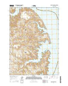
~ Iron Post Buttes SD topo map, 1:24000 scale, 7.5 X 7.5 Minute, 2015
Iron Post Buttes, South Dakota, USGS topographic map dated 2015.
Includes geographic coordinates (latitude and longitude). This topographic map is suitable for hiking, camping, and exploring, or framing it as a wall map.
Printed on-demand using high resolution imagery, on heavy weight and acid free paper, or alternatively on a variety of synthetic materials.
Topos available on paper, Waterproof, Poly, or Tyvek. Usually shipping rolled, unless combined with other folded maps in one order.
- Product Number: USGS-8010840
- Free digital map download (high-resolution, GeoPDF): Iron Post Buttes, South Dakota (file size: 23 MB)
- Map Size: please refer to the dimensions of the GeoPDF map above
- Weight (paper map): ca. 55 grams
- Map Type: POD USGS Topographic Map
- Map Series: US Topo
- Map Verison: Current
- Cell ID: 22078
- Datum: North American Datum of 1983
- Map Projection: Transverse Mercator
- Map Cell Name: Iron Post Buttes
- Grid size: 7.5 X 7.5 Minute
- Date on map: 2015
- Map Scale: 1:24000
- Geographical region: South Dakota, United States
Neighboring Maps:
All neighboring USGS topo maps are available for sale online at a variety of scales.
Spatial coverage:
Topo map Iron Post Buttes, South Dakota, covers the geographical area associated the following places:
- Sand Creek - Cooper Ranch (historical) - Fort Bennett (historical) - Agency Creek - Graham Ranch (historical) - Cheyenne River Post II (historical) - Iron Post Buttes - Saint Johns Mission (historical) - Mission Creek - Cheyenne River Agencies I and II (historical) - Whiskey Island (historical) - Walter Thompson Dam - Episcopal Boys School (historical) - J E Sheehan Estate Number 3 Dam - Little Bend (historical)
- Map Area ID: AREA44.7544.625-100.75-100.625
- Northwest corner Lat/Long code: USGSNW44.75-100.75
- Northeast corner Lat/Long code: USGSNE44.75-100.625
- Southwest corner Lat/Long code: USGSSW44.625-100.75
- Southeast corner Lat/Long code: USGSSE44.625-100.625
- Northern map edge Latitude: 44.75
- Southern map edge Latitude: 44.625
- Western map edge Longitude: -100.75
- Eastern map edge Longitude: -100.625


