
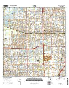
~ West Dixie Bend FL topo map, 1:24000 scale, 7.5 X 7.5 Minute, 2015
West Dixie Bend, Florida, USGS topographic map dated 2015.
Includes geographic coordinates (latitude and longitude). This topographic map is suitable for hiking, camping, and exploring, or framing it as a wall map.
Printed on-demand using high resolution imagery, on heavy weight and acid free paper, or alternatively on a variety of synthetic materials.
Topos available on paper, Waterproof, Poly, or Tyvek. Usually shipping rolled, unless combined with other folded maps in one order.
- Product Number: USGS-8006716
- Free digital map download (high-resolution, GeoPDF): West Dixie Bend, Florida (file size: 36 MB)
- Map Size: please refer to the dimensions of the GeoPDF map above
- Weight (paper map): ca. 55 grams
- Map Type: POD USGS Topographic Map
- Map Series: US Topo
- Map Verison: Current
- Cell ID: 48170
- Datum: North American Datum of 1983
- Map Projection: Transverse Mercator
- Map Cell Name: West Dixie Bend
- Grid size: 7.5 X 7.5 Minute
- Date on map: 2015
- Map Scale: 1:24000
- Geographical region: Florida, United States
Neighboring Maps:
All neighboring USGS topo maps are available for sale online at a variety of scales.
Spatial coverage:
Topo map West Dixie Bend, Florida, covers the geographical area associated the following places:
- Coral Cay Plantation Mobile Home Park - West Deerfield Beach - Country Knolls Mobile Home Park - Crystal Lake - Hometown Country Lakes Mobile Home Park - Hillsboro Ranches - West Dixie Bend - Boca Pointe - Loch Lomond - Deerfield Lake Mobile Home Park - Hillsboro Mobile Home Park - Bonnie Loch - Leisureville - Sanders Park - Parkland - Country Lakes Community Mobile Home Park - Woodsetter North - Parkridge Mobile Home Park - Mission Bay - Hillsboro Pines - Boca Del Mar - Carver Village - Coconut Creek - Coral Lake Mobile Home Park - Paradise Palms - Rancho Margate Mobile Home Park - Tallowwood Isle Mobile Home Park - Sandalfoot Cove - Lakeview - Whispering Pines Addition Mobile Home Park - Tidewater Estates Mobile Home Park
- Map Area ID: AREA26.37526.25-80.25-80.125
- Northwest corner Lat/Long code: USGSNW26.375-80.25
- Northeast corner Lat/Long code: USGSNE26.375-80.125
- Southwest corner Lat/Long code: USGSSW26.25-80.25
- Southeast corner Lat/Long code: USGSSE26.25-80.125
- Northern map edge Latitude: 26.375
- Southern map edge Latitude: 26.25
- Western map edge Longitude: -80.25
- Eastern map edge Longitude: -80.125


