
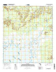
~ Waccasassa Bay FL topo map, 1:24000 scale, 7.5 X 7.5 Minute, 2015
Waccasassa Bay, Florida, USGS topographic map dated 2015.
Includes geographic coordinates (latitude and longitude). This topographic map is suitable for hiking, camping, and exploring, or framing it as a wall map.
Printed on-demand using high resolution imagery, on heavy weight and acid free paper, or alternatively on a variety of synthetic materials.
Topos available on paper, Waterproof, Poly, or Tyvek. Usually shipping rolled, unless combined with other folded maps in one order.
- Product Number: USGS-8006672
- Free digital map download (high-resolution, GeoPDF): Waccasassa Bay, Florida (file size: 25 MB)
- Map Size: please refer to the dimensions of the GeoPDF map above
- Weight (paper map): ca. 55 grams
- Map Type: POD USGS Topographic Map
- Map Series: US Topo
- Map Verison: Current
- Cell ID: 47075
- Datum: North American Datum of 1983
- Map Projection: Transverse Mercator
- Map Cell Name: Waccasassa Bay
- Grid size: 7.5 X 7.5 Minute
- Date on map: 2015
- Map Scale: 1:24000
- Geographical region: Florida, United States
Neighboring Maps:
All neighboring USGS topo maps are available for sale online at a variety of scales.
Spatial coverage:
Topo map Waccasassa Bay, Florida, covers the geographical area associated the following places:
- Compass Point Creek - Mud Creek - Trout Creek - Tenmile Creek - Cabbage Slough - Camp E - Soldiers Creek - South Point - Lone Cedar Island - Camp D - Deep Creek - Mud Creek - Calbet Slough - Sheephead Creek - Waccasassa River - Beetree Slough - Double Barrel Creek - Williams Creek - Waccasassa Bay - Cedar Key-Yankeetown Division - Wekiva River - Compass Point - Gulf Hammock - Staffords Island - Depew Creek - Cow Creek - Otter Creek - West Pass - Williams Camp - East Pass - Salt Island Creek - Ramsey Creek - Ramsey Point - Salt Island - Chicken Slough - Crooked Creek - Bird Creek - Watch Chain Slough - Dry Creek - Divedapper Creek - Rocky Run
- Map Area ID: AREA29.2529.125-82.875-82.75
- Northwest corner Lat/Long code: USGSNW29.25-82.875
- Northeast corner Lat/Long code: USGSNE29.25-82.75
- Southwest corner Lat/Long code: USGSSW29.125-82.875
- Southeast corner Lat/Long code: USGSSE29.125-82.75
- Northern map edge Latitude: 29.25
- Southern map edge Latitude: 29.125
- Western map edge Longitude: -82.875
- Eastern map edge Longitude: -82.75


