
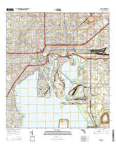
~ Tampa FL topo map, 1:24000 scale, 7.5 X 7.5 Minute, 2015
Tampa, Florida, USGS topographic map dated 2015.
Includes geographic coordinates (latitude and longitude). This topographic map is suitable for hiking, camping, and exploring, or framing it as a wall map.
Printed on-demand using high resolution imagery, on heavy weight and acid free paper, or alternatively on a variety of synthetic materials.
Topos available on paper, Waterproof, Poly, or Tyvek. Usually shipping rolled, unless combined with other folded maps in one order.
- Product Number: USGS-8006492
- Free digital map download (high-resolution, GeoPDF): Tampa, Florida (file size: 30 MB)
- Map Size: please refer to the dimensions of the GeoPDF map above
- Weight (paper map): ca. 55 grams
- Map Type: POD USGS Topographic Map
- Map Series: US Topo
- Map Verison: Current
- Cell ID: 44262
- Datum: North American Datum of 1983
- Map Projection: Transverse Mercator
- Map Cell Name: Tampa
- Grid size: 7.5 X 7.5 Minute
- Date on map: 2015
- Map Scale: 1:24000
- Geographical region: Florida, United States
Neighboring Maps:
All neighboring USGS topo maps are available for sale online at a variety of scales.
Spatial coverage:
Topo map Tampa, Florida, covers the geographical area associated the following places:
- Nix - Tampa Gardens - Roslyn Homes - Avondale - Centralia - Chesterfield Heights - Oriole - Buffalo Park - Suarez - Arlington Heights North - Panama - Witchmere - Hanley Heights - Oak Villa - Citrus Park - Hawks - Matanzas - Palm River Village - River Haven - Wellswood Estates - Michigan Broadway - Fendigs - Spivey Miller - Highburg - Casey - Suburb Royal - Whitesburg - Morrison Grove - Dorothy Park - Dyal - Chicago Avenue - Crabcake - Louisa - Barr City - Rivere - Highway Park - Stratford Place - Ben Hur - Chapin Avenue - Southern Oaks - Zion Height - Castillo Villa - Ybor City - Lamb - Ownahome - Park View - Galloway Heights - Murray Heights - Bunchville - Reese - Zambito - Eugene Terrace - Whittemore - Oakdale - Capitano - Tyner - Cones - College Heights - Shell Point Estates - Desoto Heights - Riverside - Shadowlawn - Orange Hill Heights West - Oak Park Estates - Selma - Mackmay - Kimberly Park - Clewis Court - Packwood - Oaklyn - Demorest - Harbourside at Harbour Island - Giddens - Rainbow Heights - Urbanrest - Jenkins - Fortuna - Lamour Court - Port Sutton - Roland Place - Wades Half Acres - Vicente Guerra - South Tampa Villa - Uceta Heights - Lewis Heights - Post Harbour Island - Glennoaks - Mendenhall Terrace - Michigan Heights - Lingerlong - Newnan - Salmon - Tibbettsville - West Pines - Maryland Avenue - Golds - Plainfield - Englewood - Uceta Gardens - Palm River Reserve
- Map Area ID: AREA2827.875-82.5-82.375
- Northwest corner Lat/Long code: USGSNW28-82.5
- Northeast corner Lat/Long code: USGSNE28-82.375
- Southwest corner Lat/Long code: USGSSW27.875-82.5
- Southeast corner Lat/Long code: USGSSE27.875-82.375
- Northern map edge Latitude: 28
- Southern map edge Latitude: 27.875
- Western map edge Longitude: -82.5
- Eastern map edge Longitude: -82.375


