
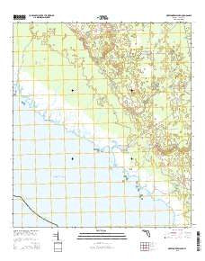
~ Okefenokee Slough FL topo map, 1:24000 scale, 7.5 X 7.5 Minute, 2015
Okefenokee Slough, Florida, USGS topographic map dated 2015.
Includes geographic coordinates (latitude and longitude). This topographic map is suitable for hiking, camping, and exploring, or framing it as a wall map.
Printed on-demand using high resolution imagery, on heavy weight and acid free paper, or alternatively on a variety of synthetic materials.
Topos available on paper, Waterproof, Poly, or Tyvek. Usually shipping rolled, unless combined with other folded maps in one order.
- Product Number: USGS-8004592
- Free digital map download (high-resolution, GeoPDF): Okefenokee Slough, Florida (file size: 27 MB)
- Map Size: please refer to the dimensions of the GeoPDF map above
- Weight (paper map): ca. 55 grams
- Map Type: POD USGS Topographic Map
- Map Series: US Topo
- Map Verison: Current
- Cell ID: 33023
- Datum: North American Datum of 1983
- Map Projection: Transverse Mercator
- Map Cell Name: Okefenokee Slough
- Grid size: 7.5 X 7.5 Minute
- Date on map: 2015
- Map Scale: 1:24000
- Geographical region: Florida, United States
Neighboring Maps:
All neighboring USGS topo maps are available for sale online at a variety of scales.
Spatial coverage:
Topo map Okefenokee Slough, Florida, covers the geographical area associated the following places:
- Otter Creek - Little Spring Creek - Mullet Creek - Holy Creek - Spring Warriors - Turkey Roost Slough - Spring Warrior Camp - Jabo Camp - Big Spring Creek - Okefenokee Slough - Yates Camp - Island Creek - Eagle Prairie - Bonita Beach - Yates Creek - Sand Creek - Adams Beach - Spring Warrior Creek - Eaglenest Creek - Eaglenest Point - Brannen Creek - Ezell Camp
- Map Area ID: AREA3029.875-83.75-83.625
- Northwest corner Lat/Long code: USGSNW30-83.75
- Northeast corner Lat/Long code: USGSNE30-83.625
- Southwest corner Lat/Long code: USGSSW29.875-83.75
- Southeast corner Lat/Long code: USGSSE29.875-83.625
- Northern map edge Latitude: 30
- Southern map edge Latitude: 29.875
- Western map edge Longitude: -83.75
- Eastern map edge Longitude: -83.625


