
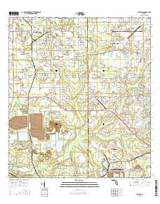
~ Nichols FL topo map, 1:24000 scale, 7.5 X 7.5 Minute, 2015
Nichols, Florida, USGS topographic map dated 2015.
Includes geographic coordinates (latitude and longitude). This topographic map is suitable for hiking, camping, and exploring, or framing it as a wall map.
Printed on-demand using high resolution imagery, on heavy weight and acid free paper, or alternatively on a variety of synthetic materials.
Topos available on paper, Waterproof, Poly, or Tyvek. Usually shipping rolled, unless combined with other folded maps in one order.
- Product Number: USGS-8004538
- Free digital map download (high-resolution, GeoPDF): Nichols, Florida (file size: 28 MB)
- Map Size: please refer to the dimensions of the GeoPDF map above
- Weight (paper map): ca. 55 grams
- Map Type: POD USGS Topographic Map
- Map Series: US Topo
- Map Verison: Current
- Cell ID: 32061
- Datum: North American Datum of 1983
- Map Projection: Transverse Mercator
- Map Cell Name: Nichols
- Grid size: 7.5 X 7.5 Minute
- Date on map: 2015
- Map Scale: 1:24000
- Geographical region: Florida, United States
Neighboring Maps:
All neighboring USGS topo maps are available for sale online at a variety of scales.
Spatial coverage:
Topo map Nichols, Florida, covers the geographical area associated the following places:
- Taulbee Acres - Pritcher Manor - Spring Hill Mobile Home Park - Busy Bee Haven Mobile Home Park - McDonald Terrace - Hopewell - West Texas Acres - Highland Creek - Fasson South - Howell Estates - Larson Acres - Nesmith Estates - Rockin T Ranch - Silver Maple Estates - Fasson - South Plant City Farms - Berry Landing - Nichols - Taman Estates - Alafia Ridge Estates - Phipps - Gulf Sierra Farms - Pratt Acres - Armijo Acres - Windmill Pointe - Thomas Hills - Kayla Ranch - Walden Woods - Colson Place - Ralston Country Estates - Colson Acres - Jones Ridge - Knoxville Acres - Wiggins Trace - Thomas Oaks - Orange Haven - Mulberry Acres - Pritcher Pines - Morrell Park - Tagliarini - Lambert - Pams Place - Alderman - D And E Acres - Gemstone Acres - Candy Cane Acres - Killebrew - Trapnell Acres - Mulberry Estates Mobile Home Park - Trapnell Oaks - Robichaud - McWetherbee Junction - Gordon - Duncans Mobile Home Park - Pollard Place - Ralston Woods - Berry Road Estates - Wiggs Estates - Trapnell East - Cook Estates - Samantha Park - Rutland Acres - Nehaul - Layton Estates - Trapnell Place - Ralston Acres - Bealsville - Perry Acres - Coronet - Sparkman Oaks - Raye Ann - Wiggins Meadows - Robinson Farms - Peacock Grove - Smith - Bailey Place Mobile Home Park - Pooran - Willow Oak II Mobile Home Park - The Palms Mobile Home Park - Hamilton Hills - Oliver Acres - Dranefield Mobile Home Park - Wild Rose - Avondale Groves - Willow Oak - Deep Roots Farms - Oakview Estates - Turner Place - Simmons Acres - Trapnell - Lexie Lane - Stockwell - Tower Ridge Estates - Register Country Acres - Tangerine Trails - Dubois Acres - Piney Oaks - Cowart Acres - Brians Pond - Cowart Oaks
- Map Area ID: AREA2827.875-82.125-82
- Northwest corner Lat/Long code: USGSNW28-82.125
- Northeast corner Lat/Long code: USGSNE28-82
- Southwest corner Lat/Long code: USGSSW27.875-82.125
- Southeast corner Lat/Long code: USGSSE27.875-82
- Northern map edge Latitude: 28
- Southern map edge Latitude: 27.875
- Western map edge Longitude: -82.125
- Eastern map edge Longitude: -82


