
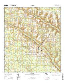
~ Juniper Creek FL topo map, 1:24000 scale, 7.5 X 7.5 Minute, 2015
Juniper Creek, Florida, USGS topographic map dated 2015.
Includes geographic coordinates (latitude and longitude). This topographic map is suitable for hiking, camping, and exploring, or framing it as a wall map.
Printed on-demand using high resolution imagery, on heavy weight and acid free paper, or alternatively on a variety of synthetic materials.
Topos available on paper, Waterproof, Poly, or Tyvek. Usually shipping rolled, unless combined with other folded maps in one order.
- Product Number: USGS-8003422
- Free digital map download (high-resolution, GeoPDF): Juniper Creek, Florida (file size: 31 MB)
- Map Size: please refer to the dimensions of the GeoPDF map above
- Weight (paper map): ca. 55 grams
- Map Type: POD USGS Topographic Map
- Map Series: US Topo
- Map Verison: Current
- Cell ID: 22933
- Datum: North American Datum of 1983
- Map Projection: Transverse Mercator
- Map Cell Name: Juniper Creek
- Grid size: 7.5 X 7.5 Minute
- Date on map: 2015
- Map Scale: 1:24000
- Geographical region: Florida, United States
Neighboring Maps:
All neighboring USGS topo maps are available for sale online at a variety of scales.
Spatial coverage:
Topo map Juniper Creek, Florida, covers the geographical area associated the following places:
- Parham Branch - Josey Branch - Phillips Branch - Shirer Branch - Bailey Branch - Mossy Pond Branch - Max Spring Branch - Woodell Branch - Steep Head Farm Airport - Watson Branch - Ditch Pond Branch - Steep Head - Parson Wright Branch - Ron Wood Airport - Calder Head - Buck Head - West Calhoun Division - Panther Branch - Rock Head - Hogpen Branch - Centerfit Branch - Taylor Branch - Big Bear Bay - Chinkapin Branch - Hickory Head - Hickory Head - Buck Head - Huey Branch - Jones Branch
- Map Area ID: AREA30.530.375-85.375-85.25
- Northwest corner Lat/Long code: USGSNW30.5-85.375
- Northeast corner Lat/Long code: USGSNE30.5-85.25
- Southwest corner Lat/Long code: USGSSW30.375-85.375
- Southeast corner Lat/Long code: USGSSE30.375-85.25
- Northern map edge Latitude: 30.5
- Southern map edge Latitude: 30.375
- Western map edge Longitude: -85.375
- Eastern map edge Longitude: -85.25


