
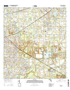
~ Dover FL topo map, 1:24000 scale, 7.5 X 7.5 Minute, 2015
Dover, Florida, USGS topographic map dated 2015.
Includes geographic coordinates (latitude and longitude). This topographic map is suitable for hiking, camping, and exploring, or framing it as a wall map.
Printed on-demand using high resolution imagery, on heavy weight and acid free paper, or alternatively on a variety of synthetic materials.
Topos available on paper, Waterproof, Poly, or Tyvek. Usually shipping rolled, unless combined with other folded maps in one order.
- Product Number: USGS-8002503
- Free digital map download (high-resolution, GeoPDF): Dover, Florida (file size: 29 MB)
- Map Size: please refer to the dimensions of the GeoPDF map above
- Weight (paper map): ca. 55 grams
- Map Type: POD USGS Topographic Map
- Map Series: US Topo
- Map Verison: Current
- Cell ID: 12691
- Datum: North American Datum of 1983
- Map Projection: Transverse Mercator
- Map Cell Name: Dover
- Grid size: 7.5 X 7.5 Minute
- Date on map: 2015
- Map Scale: 1:24000
- Geographical region: Florida, United States
Neighboring Maps:
All neighboring USGS topo maps are available for sale online at a variety of scales.
Spatial coverage:
Topo map Dover, Florida, covers the geographical area associated the following places:
- Ranch Road Groves - Sugar Cane Acres - Salem Oaks - Puntkins Place - The Cove - Canterbury Oaks - Valrico Forest - Holloway Estates - Olympus Acres - McDonald-Slone Estates - Indian Trails - Heritage Crest - Lucas Manor - Kings Mill - West Plant City - Hopewell Gardens - Pineapple Hill - Arista - Margaline Gardens - Dover - Saint Cloud Landings - Gwaltney Acres - Mason Oaks - Parrish - Wellington - Country Woods Estates - Drakes Place - Saint Cloud Oaks - Highland Country Estates - Copper Ridge - Turkey Creek - Buckhorn Trace - Welch Creek Acres - Bloomingdale - Eastgate Extension - Lehman Acres - Dover Oaks - Reynoso - Paradise Acres - Lees Ranch - Tevalo Hills - Buckhorn Groves - Greenhills - Sytsma Estates - Mulrennan Estates - Saint Cloud Reserve - Delgado - Buckingham - Walden Groves - Tract 80 Estates - The Paddocks - Westminster - Peeples Acres - Brandon Ridgeland - Oaklane Estates - Country Breeze Estates - Beattys Corner - Diamond Hill - Woodfield Village - Windcrest Commons - Fleites Acres - Graves Orchard - Pleasant Grove - Brown Estates - Waller Acres - Marvina - Martin - Pleasant Grove Acres - Turkey Creek Acres - Puntkins Patch - Buckhorn Oaks - Valrico - Eastwood Glenn - Evers Acres - Walden Lake Fairway Estates - Sydney Crossings - Fairlea Estates - Buckhorn Hills - Dunham Mobile Home Park - Brock Acres - Walden Lake Fairway Villas - Rosswell Acres - Critter Lane - Allens Cove - Duncan Groves - Simmons Estate - Holloway Plantation - Doris Swilley Acres - Abbey Grove - Little Alafia Creek Estates - Brandon Valrico Hills Estates - Sexton Acres - Gillespies Glen - The Dryden Estates - East Brandon Estates - Lithia Ridge - Redd - Hinson Acres - Saint Cloud Manor - El Pavo Vista
- Map Area ID: AREA2827.875-82.25-82.125
- Northwest corner Lat/Long code: USGSNW28-82.25
- Northeast corner Lat/Long code: USGSNE28-82.125
- Southwest corner Lat/Long code: USGSSW27.875-82.25
- Southeast corner Lat/Long code: USGSSE27.875-82.125
- Northern map edge Latitude: 28
- Southern map edge Latitude: 27.875
- Western map edge Longitude: -82.25
- Eastern map edge Longitude: -82.125


