
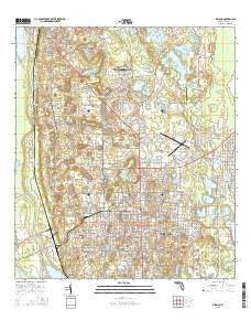
~ DeLand FL topo map, 1:24000 scale, 7.5 X 7.5 Minute, 2015
DeLand, Florida, USGS topographic map dated 2015.
Includes geographic coordinates (latitude and longitude). This topographic map is suitable for hiking, camping, and exploring, or framing it as a wall map.
Printed on-demand using high resolution imagery, on heavy weight and acid free paper, or alternatively on a variety of synthetic materials.
Topos available on paper, Waterproof, Poly, or Tyvek. Usually shipping rolled, unless combined with other folded maps in one order.
- Product Number: USGS-8002433
- Free digital map download (high-resolution, GeoPDF): DeLand, Florida (file size: 32 MB)
- Map Size: please refer to the dimensions of the GeoPDF map above
- Weight (paper map): ca. 55 grams
- Map Type: POD USGS Topographic Map
- Map Series: US Topo
- Map Verison: Current
- Cell ID: 11535
- Datum: North American Datum of 1983
- Map Projection: Transverse Mercator
- Map Cell Name: DeLand
- Grid size: 7.5 X 7.5 Minute
- Date on map: 2015
- Map Scale: 1:24000
- Geographical region: Florida, United States
Neighboring Maps:
All neighboring USGS topo maps are available for sale online at a variety of scales.
Spatial coverage:
Topo map DeLand, Florida, covers the geographical area associated the following places:
- A Better Place Mobile Home Park - Town and Country Mobile Home Park - Deland Municipal Trailer Park - Phoenix Estates Mobile Home Park - West DeLand - DeLand Highlands - Beresford - Applegate Estates Mobile Home Park - Orangewood Mobile Home Park - Meadowlea Estates Mobile Home Park - Glenwood - Lakeview Terrace Mobile Home Park - North DeLand - Hidden Valley Park Mobile Home Park - DeLand - The Oaks Mobile Home Park - Raintree Village Mobile Home Park - Lingering Lane Mobile Home Park - Brookwood Mobile Home Park - Sha De Land Mobile Home Park - Sago Palm Mobile Home Park - De Leon Springs - Fernwood Mobile Home Park - A Better Place Phase III Mobile Home Park - Cypress Lake Estates - Tallahasse - Yuchi (historical) - Palm Mobile Home Park - Hidden Hills Mobile Home Park - Hawthorne Hills of Deland Mobile Home Park - Whisperwood Manufactured Home Park
- Map Area ID: AREA29.12529-81.375-81.25
- Northwest corner Lat/Long code: USGSNW29.125-81.375
- Northeast corner Lat/Long code: USGSNE29.125-81.25
- Southwest corner Lat/Long code: USGSSW29-81.375
- Southeast corner Lat/Long code: USGSSE29-81.25
- Northern map edge Latitude: 29.125
- Southern map edge Latitude: 29
- Western map edge Longitude: -81.375
- Eastern map edge Longitude: -81.25


