
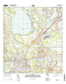
~ Bartow FL topo map, 1:24000 scale, 7.5 X 7.5 Minute, 2015
Bartow, Florida, USGS topographic map dated 2015.
Includes geographic coordinates (latitude and longitude). This topographic map is suitable for hiking, camping, and exploring, or framing it as a wall map.
Printed on-demand using high resolution imagery, on heavy weight and acid free paper, or alternatively on a variety of synthetic materials.
Topos available on paper, Waterproof, Poly, or Tyvek. Usually shipping rolled, unless combined with other folded maps in one order.
- Product Number: USGS-8001991
- Free digital map download (high-resolution, GeoPDF): Bartow, Florida (file size: 27 MB)
- Map Size: please refer to the dimensions of the GeoPDF map above
- Weight (paper map): ca. 55 grams
- Map Type: POD USGS Topographic Map
- Map Series: US Topo
- Map Verison: Current
- Cell ID: 2545
- Datum: North American Datum of 1983
- Map Projection: Transverse Mercator
- Map Cell Name: Bartow
- Grid size: 7.5 X 7.5 Minute
- Date on map: 2015
- Map Scale: 1:24000
- Geographical region: Florida, United States
Neighboring Maps:
All neighboring USGS topo maps are available for sale online at a variety of scales.
Spatial coverage:
Topo map Bartow, Florida, covers the geographical area associated the following places:
- Terio's Mobile Home Park - Eagle Lake - S P Mobile Home Park - Lake Millsite Estates Mobile Home Park - Lake Garfield - Oakwood Estates Mobile Home Park - Lyle Corner - Cox Corner - Cypress Acres Mobile Home Park - Harrells Mobile Home Park - Winter Haven Mobile Home Park - J B's Mobile Home Park - B and W Mobile Home Park - Bartow - Carroll Mobile Home Park - Connersville - Roux Quarters - Gordonville - Mid Lakes Mobile Home Park - Bartow Mobile Home Park
- Map Area ID: AREA2827.875-81.875-81.75
- Northwest corner Lat/Long code: USGSNW28-81.875
- Northeast corner Lat/Long code: USGSNE28-81.75
- Southwest corner Lat/Long code: USGSSW27.875-81.875
- Southeast corner Lat/Long code: USGSSE27.875-81.75
- Northern map edge Latitude: 28
- Southern map edge Latitude: 27.875
- Western map edge Longitude: -81.875
- Eastern map edge Longitude: -81.75


