
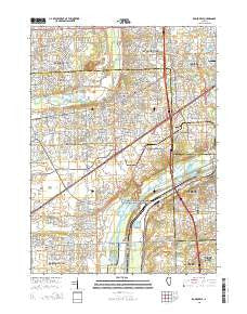
~ Romeoville IL topo map, 1:24000 scale, 7.5 X 7.5 Minute, 2015
Romeoville, Illinois, USGS topographic map dated 2015.
Includes geographic coordinates (latitude and longitude). This topographic map is suitable for hiking, camping, and exploring, or framing it as a wall map.
Printed on-demand using high resolution imagery, on heavy weight and acid free paper, or alternatively on a variety of synthetic materials.
Topos available on paper, Waterproof, Poly, or Tyvek. Usually shipping rolled, unless combined with other folded maps in one order.
- Product Number: USGS-7999827
- Free digital map download (high-resolution, GeoPDF): Romeoville, Illinois (file size: 25 MB)
- Map Size: please refer to the dimensions of the GeoPDF map above
- Weight (paper map): ca. 55 grams
- Map Type: POD USGS Topographic Map
- Map Series: US Topo
- Map Verison: Current
- Cell ID: 38502
- Datum: North American Datum of 1983
- Map Projection: Transverse Mercator
- Map Cell Name: Romeoville
- Grid size: 7.5 X 7.5 Minute
- Date on map: 2015
- Map Scale: 1:24000
- Geographical region: Illinois, United States
Neighboring Maps:
All neighboring USGS topo maps are available for sale online at a variety of scales.
Spatial coverage:
Topo map Romeoville, Illinois, covers the geographical area associated the following places:
- Cherrywood - Beaconridge - Winston Village - Claridge Estates - Home Run - Emerald Acres - Haley Meadows - Lakewood Estates - Woodridge - Barbers Corners - Bradford Place - Heritage Place - Pepper Tree - Walnut Ridge - Cache Lake - Walnut Woods - Ivanhoe - Kings Park - Willow Grove - Honeytree - Hampton Park - Colonial Village - Cinnamon Creek - Big Run Acres - Lakewood Ridge - Bayberry Ridge - Farmington - River Woods Estates - Quail Grove - Woodleaf - Welco Corners - Stonegate - Lemont - Heritage Creek - Westbury - Royce Hill - Indian Oaks - Malibu Bay - Bloomfield Village - Bolingbrook - Meadowdale Estates - Winston Woods - Basham Carriage Manor Estates - Romeoville - Heather Sound - Hunters Trail - Poplar Ridge - Brookwood Estates - Nottingham Ridge - Romeo - Marquettes Landing - Sugar Brook - Drafke - Darien
- Map Area ID: AREA41.7541.625-88.125-88
- Northwest corner Lat/Long code: USGSNW41.75-88.125
- Northeast corner Lat/Long code: USGSNE41.75-88
- Southwest corner Lat/Long code: USGSSW41.625-88.125
- Southeast corner Lat/Long code: USGSSE41.625-88
- Northern map edge Latitude: 41.75
- Southern map edge Latitude: 41.625
- Western map edge Longitude: -88.125
- Eastern map edge Longitude: -88


