
~ Rattlesnake Bayou MS topo map, 1:24000 scale, 7.5 X 7.5 Minute, 2015
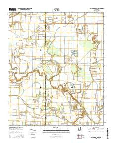
Rattlesnake Bayou, Mississippi, USGS topographic map dated 2015.
Includes geographic coordinates (latitude and longitude). This topographic map is suitable for hiking, camping, and exploring, or framing it as a wall map.
Printed on-demand using high resolution imagery, on heavy weight and acid free paper, or alternatively on a variety of synthetic materials.
Topos available on paper, Waterproof, Poly, or Tyvek. Usually shipping rolled, unless combined with other folded maps in one order.
- Product Number: USGS-7995165
- Free digital map download (high-resolution, GeoPDF): Rattlesnake Bayou, Mississippi (file size: 22 MB)
- Map Size: please refer to the dimensions of the GeoPDF map above
- Weight (paper map): ca. 55 grams
- Map Type: POD USGS Topographic Map
- Map Series: US Topo
- Map Verison: Current
- Cell ID: 37103
- Datum: North American Datum of 1983
- Map Projection: Transverse Mercator
- Map Cell Name: Rattlesnake Bayou
- Grid size: 7.5 X 7.5 Minute
- Date on map: 2015
- Map Scale: 1:24000
- Geographical region: Mississippi, United States
Neighboring Maps:
All neighboring USGS topo maps are available for sale online at a variety of scales.
Spatial coverage:
Topo map Rattlesnake Bayou, Mississippi, covers the geographical area associated the following places:
- Saint Marks Church - Rattlesnake Bayou - Truevine Church - Dugan Bayou - Morning Star Church - Peedee Plantation Lake - Saint Mary Church - Naird Church (historical) - Pecan Bayou - Peters Rock Church (historical) - Williams Chapel (historical) - Union Grove Church - I John Church - Harts Church (historical) - Mount Vernon Church - New Bethel Church - Jones Chapel - Church of God - Fighting Bayou - Gidwitz School (historical) - Hugh Aarant Ponds Dam
- Map Area ID: AREA33.7533.625-90.5-90.375
- Northwest corner Lat/Long code: USGSNW33.75-90.5
- Northeast corner Lat/Long code: USGSNE33.75-90.375
- Southwest corner Lat/Long code: USGSSW33.625-90.5
- Southeast corner Lat/Long code: USGSSE33.625-90.375
- Northern map edge Latitude: 33.75
- Southern map edge Latitude: 33.625
- Western map edge Longitude: -90.5
- Eastern map edge Longitude: -90.375


