
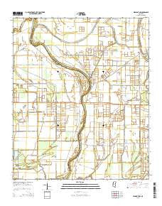
~ Midnight NW MS topo map, 1:24000 scale, 7.5 X 7.5 Minute, 2015
Midnight NW, Mississippi, USGS topographic map dated 2015.
Includes geographic coordinates (latitude and longitude). This topographic map is suitable for hiking, camping, and exploring, or framing it as a wall map.
Printed on-demand using high resolution imagery, on heavy weight and acid free paper, or alternatively on a variety of synthetic materials.
Topos available on paper, Waterproof, Poly, or Tyvek. Usually shipping rolled, unless combined with other folded maps in one order.
- Product Number: USGS-7994605
- Free digital map download (high-resolution, GeoPDF): Midnight NW, Mississippi (file size: 22 MB)
- Map Size: please refer to the dimensions of the GeoPDF map above
- Weight (paper map): ca. 55 grams
- Map Type: POD USGS Topographic Map
- Map Series: US Topo
- Map Verison: Current
- Cell ID: 29158
- Datum: North American Datum of 1983
- Map Projection: Transverse Mercator
- Map Cell Name: Midnight NW
- Grid size: 7.5 X 7.5 Minute
- Date on map: 2015
- Map Scale: 1:24000
- Geographical region: Mississippi, United States
Neighboring Maps:
All neighboring USGS topo maps are available for sale online at a variety of scales.
Spatial coverage:
Topo map Midnight NW, Mississippi, covers the geographical area associated the following places:
- Lock Church (historical) - Booth Lake Dam - Cold Lake Church - H D Tharp Lake Dam - R B Hoke Lake Dam - Cochran Brothers Lake Dam - O J Turner Third Lake Dam - Supervisor District 2 - Tisdale Lake Dam - R L Hoke Lake Dam - Dave Jones Catfish Ponds Dam - Herron Brothers Lake Dam - H D Tharp Pond Dam - Mills Bayou - Rising Star Church (historical) - Watson School (historical) - Broad Lake - Grant Lake Dam - Martin Hawkins Pond Dam - Martin Lake - Beasley Bayou - H D Tharp Pond Dam - Sunflower Chapel - Central Church - New Foundation Church (historical) - Slater Ferry (historical) - Pickell Lake Dam
- Map Area ID: AREA33.2533.125-90.75-90.625
- Northwest corner Lat/Long code: USGSNW33.25-90.75
- Northeast corner Lat/Long code: USGSNE33.25-90.625
- Southwest corner Lat/Long code: USGSSW33.125-90.75
- Southeast corner Lat/Long code: USGSSE33.125-90.625
- Northern map edge Latitude: 33.25
- Southern map edge Latitude: 33.125
- Western map edge Longitude: -90.75
- Eastern map edge Longitude: -90.625


