
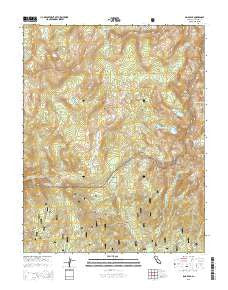
~ Sing Peak CA topo map, 1:24000 scale, 7.5 X 7.5 Minute, 2015
Sing Peak, California, USGS topographic map dated 2015.
Includes geographic coordinates (latitude and longitude). This topographic map is suitable for hiking, camping, and exploring, or framing it as a wall map.
Printed on-demand using high resolution imagery, on heavy weight and acid free paper, or alternatively on a variety of synthetic materials.
Topos available on paper, Waterproof, Poly, or Tyvek. Usually shipping rolled, unless combined with other folded maps in one order.
- Product Number: USGS-7983354
- Free digital map download (high-resolution, GeoPDF): Sing Peak, California (file size: 29 MB)
- Map Size: please refer to the dimensions of the GeoPDF map above
- Weight (paper map): ca. 55 grams
- Map Type: POD USGS Topographic Map
- Map Series: US Topo
- Map Verison: Current
- Cell ID: 72534
- Datum: North American Datum of 1983
- Map Projection: Transverse Mercator
- Map Cell Name: Sing Peak
- Grid size: 7.5 X 7.5 Minute
- Date on map: 2015
- Map Scale: 1:24000
- Geographical region: California, United States
Neighboring Maps:
All neighboring USGS topo maps are available for sale online at a variety of scales.
Spatial coverage:
Topo map Sing Peak, California, covers the geographical area associated the following places:
- Mud Lakes - Swamp Lake - Fernandez Pass - Upper Chiquito Campground - Walker Mine - Blackie Lake - Quartz Mountain - Gale Lake - Givens Creek - Brophy Meadow - Buck Camp Ranger Station - Klette Meadow - Givens Meadow - Spotted Lakes - Breeze Lake - Moraine Meadows - Grizzly Creek - Chiquito Pass - Hoover Lakes - Mount Bruce - Cold Springs Meadow - Gale Peak - Chain Lakes - East Fork Chiquito Creek - Moraine Mountain - Shirley Lake - Alpine Lake - Sing Peak - Gravelly Ford - Givens Lake - Grizzly Pass - Buck Creek - Buena Vista Crest - Chiquito Lake - Merced Pass - Redtop - Upper Merced Pass Lake - Madera Peak - Chittenden Lake
- Map Area ID: AREA37.62537.5-119.5-119.375
- Northwest corner Lat/Long code: USGSNW37.625-119.5
- Northeast corner Lat/Long code: USGSNE37.625-119.375
- Southwest corner Lat/Long code: USGSSW37.5-119.5
- Southeast corner Lat/Long code: USGSSE37.5-119.375
- Northern map edge Latitude: 37.625
- Southern map edge Latitude: 37.5
- Western map edge Longitude: -119.5
- Eastern map edge Longitude: -119.375


