
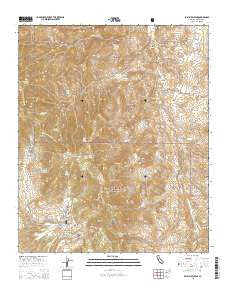
~ Palm View Peak CA topo map, 1:24000 scale, 7.5 X 7.5 Minute, 2015
Palm View Peak, California, USGS topographic map dated 2015.
Includes geographic coordinates (latitude and longitude). This topographic map is suitable for hiking, camping, and exploring, or framing it as a wall map.
Printed on-demand using high resolution imagery, on heavy weight and acid free paper, or alternatively on a variety of synthetic materials.
Topos available on paper, Waterproof, Poly, or Tyvek. Usually shipping rolled, unless combined with other folded maps in one order.
- Product Number: USGS-7981780
- Free digital map download (high-resolution, GeoPDF): Palm View Peak, California (file size: 28 MB)
- Map Size: please refer to the dimensions of the GeoPDF map above
- Weight (paper map): ca. 55 grams
- Map Type: POD USGS Topographic Map
- Map Series: US Topo
- Map Verison: Current
- Cell ID: 33997
- Datum: North American Datum of 1983
- Map Projection: Transverse Mercator
- Map Cell Name: Palm View Peak
- Grid size: 7.5 X 7.5 Minute
- Date on map: 2015
- Map Scale: 1:24000
- Geographical region: California, United States
Neighboring Maps:
All neighboring USGS topo maps are available for sale online at a variety of scales.
Spatial coverage:
Topo map Palm View Peak, California, covers the geographical area associated the following places:
- Oak Canyon - Eagle Spring - Devils Rockpile - Dry Camp Canyon - Needles Eye - Wild Grape Spring - Garnet Ridge - Camp Joe Scherman - Fobes Saddle - Bulls Eye Rock - Maynard Mine - Apache Spring - Birthday Flat - Fobes Ranch - McGregor Flat - Pyramid Peak - Spitler Peak - Potrero Canyon - Fobes Spring - Little Desert - Little Paradise - Landslide Spring - Agua Fuerte Spring - Live Oak Canyon - Dry Wash - Little Camp Spring - Hop Patch Spring - Dutch Charlie Canyon - Indian Potrero - Wentworth Canyon - Mad Woman Spring - Desert Divide Trail - Palm View Peak - Duchess Spring - Duchess Canyon - Sacaton Flat - Agua Bonita Spring - West Fork Palm Canyon - Cedar Spring - Gooseberry Spring - Cone Peak - East Fork Palm Canyon - Bald Mountain - Sirocco Palms - Morris Ranch - Tripp Meadow - Hidden Falls - Pine Mountain - Cedar Creek - Lion Spring - Root Spring - Rock House - Oak Canyon Spring - Mesquite Flat - Rock Canyon - Indian Spring - Bullseye Flat - Dos Palmas Spring - Hermits Bench - Hells Kitchen - Lion Peak - Goff Flat
- Map Area ID: AREA33.7533.625-116.625-116.5
- Northwest corner Lat/Long code: USGSNW33.75-116.625
- Northeast corner Lat/Long code: USGSNE33.75-116.5
- Southwest corner Lat/Long code: USGSSW33.625-116.625
- Southeast corner Lat/Long code: USGSSE33.625-116.5
- Northern map edge Latitude: 33.75
- Southern map edge Latitude: 33.625
- Western map edge Longitude: -116.625
- Eastern map edge Longitude: -116.5


