
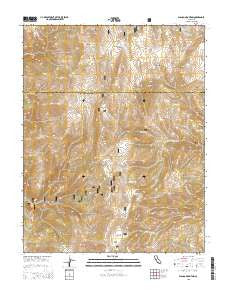
~ Blanco Mountain CA topo map, 1:24000 scale, 7.5 X 7.5 Minute, 2015
Blanco Mountain, California, USGS topographic map dated 2015.
Includes geographic coordinates (latitude and longitude). This topographic map is suitable for hiking, camping, and exploring, or framing it as a wall map.
Printed on-demand using high resolution imagery, on heavy weight and acid free paper, or alternatively on a variety of synthetic materials.
Topos available on paper, Waterproof, Poly, or Tyvek. Usually shipping rolled, unless combined with other folded maps in one order.
- Product Number: USGS-7975879
- Free digital map download (high-resolution, GeoPDF): Blanco Mountain, California (file size: 26 MB)
- Map Size: please refer to the dimensions of the GeoPDF map above
- Weight (paper map): ca. 55 grams
- Map Type: POD USGS Topographic Map
- Map Series: US Topo
- Map Verison: Current
- Cell ID: 4347
- Datum: North American Datum of 1983
- Map Projection: Transverse Mercator
- Map Cell Name: Blanco Mountain
- Grid size: 7.5 X 7.5 Minute
- Date on map: 2015
- Map Scale: 1:24000
- Geographical region: California, United States
Neighboring Maps:
All neighboring USGS topo maps are available for sale online at a variety of scales.
Spatial coverage:
Topo map Blanco Mountain, California, covers the geographical area associated the following places:
- Bristlecone Visitor Center - Schulman Grove Visitor Center - White Mountain Research Station - Schulman Grove Picnic Site - Ancient Bristlecone Pine Forest - Schulman Grove - Mexican Mine - Big Prospector Meadow - Schulman-Methusalah Trailhead - Goat Spring - Cedar Spring - County Line Hill - Sage Hen Flat - South Fork Crooked Creek - Camp Bristlecone - Bucks Peak - Clem Nelson Peak - Reed Flat - KIBS-FM (Bishop) - Blanco Mountain - See Remarks - Schulman Grove Picnic Area - North Fork Crooked Creek - Discovery Trail - Coldwater Spring - Methuselah Trail - Campito Mountain
- Map Area ID: AREA37.537.375-118.25-118.125
- Northwest corner Lat/Long code: USGSNW37.5-118.25
- Northeast corner Lat/Long code: USGSNE37.5-118.125
- Southwest corner Lat/Long code: USGSSW37.375-118.25
- Southeast corner Lat/Long code: USGSSE37.375-118.125
- Northern map edge Latitude: 37.5
- Southern map edge Latitude: 37.375
- Western map edge Longitude: -118.25
- Eastern map edge Longitude: -118.125


