
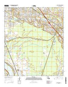
~ Saint Gabriel LA topo map, 1:24000 scale, 7.5 X 7.5 Minute, 2015
Saint Gabriel, Louisiana, USGS topographic map dated 2015.
Includes geographic coordinates (latitude and longitude). This topographic map is suitable for hiking, camping, and exploring, or framing it as a wall map.
Printed on-demand using high resolution imagery, on heavy weight and acid free paper, or alternatively on a variety of synthetic materials.
Topos available on paper, Waterproof, Poly, or Tyvek. Usually shipping rolled, unless combined with other folded maps in one order.
- Product Number: USGS-7974925
- Free digital map download (high-resolution, GeoPDF): Saint Gabriel, Louisiana (file size: 30 MB)
- Map Size: please refer to the dimensions of the GeoPDF map above
- Weight (paper map): ca. 55 grams
- Map Type: POD USGS Topographic Map
- Map Series: US Topo
- Map Verison: Current
- Cell ID: 39268
- Datum: North American Datum of 1983
- Map Projection: Transverse Mercator
- Map Cell Name: Saint Gabriel
- Grid size: 7.5 X 7.5 Minute
- Date on map: 2015
- Map Scale: 1:24000
- Geographical region: Louisiana, United States
Neighboring Maps:
All neighboring USGS topo maps are available for sale online at a variety of scales.
Spatial coverage:
Topo map Saint Gabriel, Louisiana, covers the geographical area associated the following places:
- Iberville - Village Saint George - Highland Community - Barkley Place - Perkins South - Briarwood Estates - Round Oak - Chatsworth Acres - Highlandia - Lakeland Terrace - Oakley - Oak Hills - Castle Ridge Estates - Oakbrook - Wildwood - Willow Glen - Quail Ridge - Saint Gabriel - Highland Estates - Brown (historical) - Siegen - The Highlands - Westchester - Brousard Plaza - Autumn Run - The Shire - Highland Lakes - Castille - Montan Estates - Foreman - Meadow Park - Quail Hollow - Brookhollow Glen - Lakeside - Rhodes - Bluebonnet Ridge - Bayou Paul - Iberville Terrace - Highland Crossing - Hydell - Kleinpeter - Oak Hills Place - The Myrtles - Briarcliff - Terra Haute - Lafitte Hill - Perkins Village
- Map Area ID: AREA30.37530.25-91.125-91
- Northwest corner Lat/Long code: USGSNW30.375-91.125
- Northeast corner Lat/Long code: USGSNE30.375-91
- Southwest corner Lat/Long code: USGSSW30.25-91.125
- Southeast corner Lat/Long code: USGSSE30.25-91
- Northern map edge Latitude: 30.375
- Southern map edge Latitude: 30.25
- Western map edge Longitude: -91.125
- Eastern map edge Longitude: -91


