
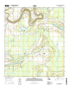
~ Lac Sainte Agnes LA topo map, 1:24000 scale, 7.5 X 7.5 Minute, 2015
Lac Sainte Agnes, Louisiana, USGS topographic map dated 2015.
Includes geographic coordinates (latitude and longitude). This topographic map is suitable for hiking, camping, and exploring, or framing it as a wall map.
Printed on-demand using high resolution imagery, on heavy weight and acid free paper, or alternatively on a variety of synthetic materials.
Topos available on paper, Waterproof, Poly, or Tyvek. Usually shipping rolled, unless combined with other folded maps in one order.
- Product Number: USGS-7974149
- Free digital map download (high-resolution, GeoPDF): Lac Sainte Agnes, Louisiana (file size: 26 MB)
- Map Size: please refer to the dimensions of the GeoPDF map above
- Weight (paper map): ca. 55 grams
- Map Type: POD USGS Topographic Map
- Map Series: US Topo
- Map Verison: Current
- Cell ID: 24198
- Datum: North American Datum of 1983
- Map Projection: Transverse Mercator
- Map Cell Name: Lac Sainte Agnes
- Grid size: 7.5 X 7.5 Minute
- Date on map: 2015
- Map Scale: 1:24000
- Geographical region: Louisiana, United States
Neighboring Maps:
All neighboring USGS topo maps are available for sale online at a variety of scales.
Spatial coverage:
Topo map Lac Sainte Agnes, Louisiana, covers the geographical area associated the following places:
- Petit Lac du Grand Bryon - Pointe Tournant - Mouillere a Dehors - Baie Sec - Lac Bryon de Chats - Bill Book Lake - Grand Cyprière - Bayou de la Glaise - La Coulee à Elphege - Big Canal - Bayou Chambré - Petit Lac Saulière - Bayou La Croix - Bayou La Taure - Bayou Cocodrie - Little River Oil Field - Louisiana Delta South End Landing Strip - Lac Clair - La Paries Church - Cyprière à Oncle John - Long Fork - Lac Ophelia - Old Red River - Lac Sainte Agnes - Lake Frazier Swamp - Short Fork - Lac Grand Bayou - La Saulière - Lac Barbue - Lac Moreau - Lake Ophelia National Wildlife Refuge - Lake Little Solier - Lac a Paul - Lac Valerie - Lac en Travers - Parish Governing Authority District 3 - Bayou Voiche - Twisty Bayou - Lac Saulière - Lac Ambroise - Lake Ophelia Oil Field - Saint James Chapel - Indian Cypress Brake - Bayou Voinche - Westcut Lake
- Map Area ID: AREA31.2531.125-92-91.875
- Northwest corner Lat/Long code: USGSNW31.25-92
- Northeast corner Lat/Long code: USGSNE31.25-91.875
- Southwest corner Lat/Long code: USGSSW31.125-92
- Southeast corner Lat/Long code: USGSSE31.125-91.875
- Northern map edge Latitude: 31.25
- Southern map edge Latitude: 31.125
- Western map edge Longitude: -92
- Eastern map edge Longitude: -91.875


