
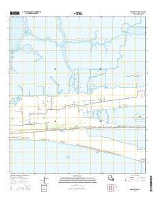
~ Grand Bayou LA topo map, 1:24000 scale, 7.5 X 7.5 Minute, 2015
Grand Bayou, Louisiana, USGS topographic map dated 2015.
Includes geographic coordinates (latitude and longitude). This topographic map is suitable for hiking, camping, and exploring, or framing it as a wall map.
Printed on-demand using high resolution imagery, on heavy weight and acid free paper, or alternatively on a variety of synthetic materials.
Topos available on paper, Waterproof, Poly, or Tyvek. Usually shipping rolled, unless combined with other folded maps in one order.
- Product Number: USGS-7973789
- Free digital map download (high-resolution, GeoPDF): Grand Bayou, Louisiana (file size: 22 MB)
- Map Size: please refer to the dimensions of the GeoPDF map above
- Weight (paper map): ca. 55 grams
- Map Type: POD USGS Topographic Map
- Map Series: US Topo
- Map Verison: Current
- Cell ID: 17951
- Datum: North American Datum of 1983
- Map Projection: Transverse Mercator
- Map Cell Name: Grand Bayou
- Grid size: 7.5 X 7.5 Minute
- Date on map: 2015
- Map Scale: 1:24000
- Geographical region: Louisiana, United States
Neighboring Maps:
All neighboring USGS topo maps are available for sale online at a variety of scales.
Spatial coverage:
Topo map Grand Bayou, Louisiana, covers the geographical area associated the following places:
- Broussard Lake - Front Ridge - Cameron Parish - First Baptist Cemetery - La Bove Cemetery - Parish Governing Authority District 5 - North Creole Gas Field - Midway Church - Duhon Cemetery - East Prong of Grand Bayou - Lambert Lake - Cameron Vocational Technical School - Sacred Heart Church - East Cove - Herbert School - Cameron Prairie National Wildlife Refuge - Saint Theresa Church - Grand Bayou - Creole Canal - South Prong of Grand Bayou - Mesquite Ridge - Ebenezer Church - South Cameron Memorial Hospital - Cameron Parish Police Jury Barn - Sacred Heart Church - Creole School - Evergreen Heliport - Moore School - West Creole Gas Field - Saint Rose Church - Lambert Bayou
- Map Area ID: AREA29.87529.75-93.25-93.125
- Northwest corner Lat/Long code: USGSNW29.875-93.25
- Northeast corner Lat/Long code: USGSNE29.875-93.125
- Southwest corner Lat/Long code: USGSSW29.75-93.25
- Southeast corner Lat/Long code: USGSSE29.75-93.125
- Northern map edge Latitude: 29.875
- Southern map edge Latitude: 29.75
- Western map edge Longitude: -93.25
- Eastern map edge Longitude: -93.125


