
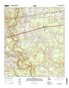
~ Denham Springs LA topo map, 1:24000 scale, 7.5 X 7.5 Minute, 2015
Denham Springs, Louisiana, USGS topographic map dated 2015.
Includes geographic coordinates (latitude and longitude). This topographic map is suitable for hiking, camping, and exploring, or framing it as a wall map.
Printed on-demand using high resolution imagery, on heavy weight and acid free paper, or alternatively on a variety of synthetic materials.
Topos available on paper, Waterproof, Poly, or Tyvek. Usually shipping rolled, unless combined with other folded maps in one order.
- Product Number: USGS-7973365
- Free digital map download (high-resolution, GeoPDF): Denham Springs, Louisiana (file size: 31 MB)
- Map Size: please refer to the dimensions of the GeoPDF map above
- Weight (paper map): ca. 55 grams
- Map Type: POD USGS Topographic Map
- Map Series: US Topo
- Map Verison: Current
- Cell ID: 11933
- Datum: North American Datum of 1983
- Map Projection: Transverse Mercator
- Map Cell Name: Denham Springs
- Grid size: 7.5 X 7.5 Minute
- Date on map: 2015
- Map Scale: 1:24000
- Geographical region: Louisiana, United States
Neighboring Maps:
All neighboring USGS topo maps are available for sale online at a variety of scales.
Spatial coverage:
Topo map Denham Springs, Louisiana, covers the geographical area associated the following places:
- Shenandoah Ridge - Pate Place - Lockhart - Riverview - Seven Oaks Mobile Home Park - Shenandoah Trails - Deville's Mobile Home Park - Denham Springs - A and W Mobile Home Park - Platation Acres - Big D Mobile Home Park - Hendricks Mobile Home Park - The Woods - Eastover Estates Mobile Home Park - Frenchtown Acres - Shenandoah Estates - Eden Church Road Mobile Park
- Map Area ID: AREA30.530.375-91-90.875
- Northwest corner Lat/Long code: USGSNW30.5-91
- Northeast corner Lat/Long code: USGSNE30.5-90.875
- Southwest corner Lat/Long code: USGSSW30.375-91
- Southeast corner Lat/Long code: USGSSE30.375-90.875
- Northern map edge Latitude: 30.5
- Southern map edge Latitude: 30.375
- Western map edge Longitude: -91
- Eastern map edge Longitude: -90.875


