
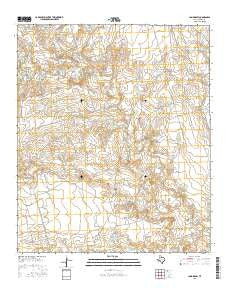
~ Long Draw TX topo map, 1:24000 scale, 7.5 X 7.5 Minute, 2016
Long Draw, Texas, USGS topographic map dated 2016.
Includes geographic coordinates (latitude and longitude). This topographic map is suitable for hiking, camping, and exploring, or framing it as a wall map.
Printed on-demand using high resolution imagery, on heavy weight and acid free paper, or alternatively on a variety of synthetic materials.
Topos available on paper, Waterproof, Poly, or Tyvek. Usually shipping rolled, unless combined with other folded maps in one order.
- Product Number: USGS-7931151
- Free digital map download (high-resolution, GeoPDF): Long Draw, Texas (file size: 24 MB)
- Map Size: please refer to the dimensions of the GeoPDF map above
- Weight (paper map): ca. 55 grams
- Map Type: POD USGS Topographic Map
- Map Series: US Topo
- Map Verison: Current
- Cell ID: 26431
- Datum: North American Datum of 1983
- Map Projection: Transverse Mercator
- Map Cell Name: Long Draw
- Grid size: 7.5 X 7.5 Minute
- Date on map: 2016
- Map Scale: 1:24000
- Geographical region: Texas, United States
Neighboring Maps:
All neighboring USGS topo maps are available for sale online at a variety of scales.
Spatial coverage:
Topo map Long Draw, Texas, covers the geographical area associated the following places:
- Crane Draw - Long Draw - Good Oil Field - Anderson Home Tank Dam - Anderson Tobacco Tank Dam - Green Tank - Creighton Lake Dam - Johnson Trap Tank - Flat Tank - Johnson Tank - East Tank - Flint Tank - North Tank - Hutto Tank - Draw One Tank - Draw Two Tank - Tobacco Tank - Salt Draw Tank - Salt Creek - Creighton Lake - Coon Hollow - Home Tank - Long Draw Tank - Two Section Tank - Round Tank - Bluff Tank - Muleshoe Ranch - Wolf Tank - New Green Tank - Tobacco Creek - Battery Tank - Sand Tank - Mud Draw Tank - Seepy Tank - Slough Tank - Draw Three Tank - Bull Tank - Vacation Tank - Railroad Tank - North Flat Tank
- Map Area ID: AREA32.7532.625-101.625-101.5
- Northwest corner Lat/Long code: USGSNW32.75-101.625
- Northeast corner Lat/Long code: USGSNE32.75-101.5
- Southwest corner Lat/Long code: USGSSW32.625-101.625
- Southeast corner Lat/Long code: USGSSE32.625-101.5
- Northern map edge Latitude: 32.75
- Southern map edge Latitude: 32.625
- Western map edge Longitude: -101.625
- Eastern map edge Longitude: -101.5


