
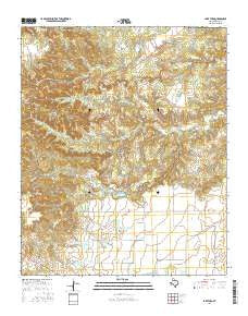
~ Lake Theo TX topo map, 1:24000 scale, 7.5 X 7.5 Minute, 2016
Lake Theo, Texas, USGS topographic map dated 2016.
Includes geographic coordinates (latitude and longitude). This topographic map is suitable for hiking, camping, and exploring, or framing it as a wall map.
Printed on-demand using high resolution imagery, on heavy weight and acid free paper, or alternatively on a variety of synthetic materials.
Topos available on paper, Waterproof, Poly, or Tyvek. Usually shipping rolled, unless combined with other folded maps in one order.
- Product Number: USGS-7927739
- Free digital map download (high-resolution, GeoPDF): Lake Theo, Texas (file size: 31 MB)
- Map Size: please refer to the dimensions of the GeoPDF map above
- Weight (paper map): ca. 55 grams
- Map Type: POD USGS Topographic Map
- Map Series: US Topo
- Map Verison: Current
- Cell ID: 70635
- Datum: North American Datum of 1983
- Map Projection: Transverse Mercator
- Map Cell Name: Lake Theo
- Grid size: 7.5 X 7.5 Minute
- Date on map: 2016
- Map Scale: 1:24000
- Geographical region: Texas, United States
Neighboring Maps:
All neighboring USGS topo maps are available for sale online at a variety of scales.
Spatial coverage:
Topo map Lake Theo, Texas, covers the geographical area associated the following places:
- North Prong Little Red River - Eagles Point - Gyp Springs - Lake Theo - Caprock Canyons State Park and Trailway - Holmes Creek - Dry Creek Lake - Soil Conservation Service Site 2 Reservoir - Caprock Canyons State Park - Soil Conservation Service Site 3 Dam - Soil Conservation Service Site 1 Dam - Hawkins Lake Dam - Ladder Tank - Soil Conservation Service Site 3 Reservoir - Lake Theo Dam - Soil Conservation Service Site 1 Reservoir - Soil Conservation Service Site 2 Dam - Luther Lake - Old Flat Top - Dry Creek - Hawkins Lake - Luther Lake Dam - Quitaque Division - John Haynes Ridge - South Prong Little Red River - Natural Bridge - Collier Tank - Collier Tank Dam
- Map Area ID: AREA34.534.375-101.125-101
- Northwest corner Lat/Long code: USGSNW34.5-101.125
- Northeast corner Lat/Long code: USGSNE34.5-101
- Southwest corner Lat/Long code: USGSSW34.375-101.125
- Southeast corner Lat/Long code: USGSSE34.375-101
- Northern map edge Latitude: 34.5
- Southern map edge Latitude: 34.375
- Western map edge Longitude: -101.125
- Eastern map edge Longitude: -101


