
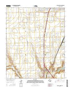
~ Buffalo Stadium TX topo map, 1:24000 scale, 7.5 X 7.5 Minute, 2016
Buffalo Stadium, Texas, USGS topographic map dated 2016.
Includes geographic coordinates (latitude and longitude). This topographic map is suitable for hiking, camping, and exploring, or framing it as a wall map.
Printed on-demand using high resolution imagery, on heavy weight and acid free paper, or alternatively on a variety of synthetic materials.
Topos available on paper, Waterproof, Poly, or Tyvek. Usually shipping rolled, unless combined with other folded maps in one order.
- Product Number: USGS-7926697
- Free digital map download (high-resolution, GeoPDF): Buffalo Stadium, Texas (file size: 22 MB)
- Map Size: please refer to the dimensions of the GeoPDF map above
- Weight (paper map): ca. 55 grams
- Map Type: POD USGS Topographic Map
- Map Series: US Topo
- Map Verison: Current
- Cell ID: 6081
- Datum: North American Datum of 1983
- Map Projection: Transverse Mercator
- Map Cell Name: Buffalo Stadium
- Grid size: 7.5 X 7.5 Minute
- Date on map: 2016
- Map Scale: 1:24000
- Geographical region: Texas, United States
Neighboring Maps:
All neighboring USGS topo maps are available for sale online at a variety of scales.
Spatial coverage:
Topo map Buffalo Stadium, Texas, covers the geographical area associated the following places:
- Randall County Fire and Rescue Station 2 - Amarillo Trinity Fellowship School Stadium - Buffalo Stadium - Lamount Drive Baptist Church - Frog Lake - Tierra Blanca Creek - Valleyview Junior High School - Spring Draw - Maples Field - Frog Dam - Canyon City Club - Lakeview Elementary School - Palo Duro Club Lake Dam - Randall High School - Palo Duro Creek - Memory Gardens Cemetery - Buffalo Airport - North Randall Division (historical) - Palo Duro Club Lake - Amarillo Division - Gene Howe Elementary School - Sundown Lane Elementary School - T-Anchor Ranch Cemetery - KPUR-FM (Canyon)
- Map Area ID: AREA35.12535-102-101.875
- Northwest corner Lat/Long code: USGSNW35.125-102
- Northeast corner Lat/Long code: USGSNE35.125-101.875
- Southwest corner Lat/Long code: USGSSW35-102
- Southeast corner Lat/Long code: USGSSE35-101.875
- Northern map edge Latitude: 35.125
- Southern map edge Latitude: 35
- Western map edge Longitude: -102
- Eastern map edge Longitude: -101.875


