
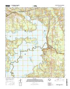
~ Wright Patman Lake TX topo map, 1:24000 scale, 7.5 X 7.5 Minute, 2016
Wright Patman Lake, Texas, USGS topographic map dated 2016.
Includes geographic coordinates (latitude and longitude). This topographic map is suitable for hiking, camping, and exploring, or framing it as a wall map.
Printed on-demand using high resolution imagery, on heavy weight and acid free paper, or alternatively on a variety of synthetic materials.
Topos available on paper, Waterproof, Poly, or Tyvek. Usually shipping rolled, unless combined with other folded maps in one order.
- Product Number: USGS-7926637
- Free digital map download (high-resolution, GeoPDF): Wright Patman Lake, Texas (file size: 21 MB)
- Map Size: please refer to the dimensions of the GeoPDF map above
- Weight (paper map): ca. 55 grams
- Map Type: POD USGS Topographic Map
- Map Series: US Topo
- Map Verison: Current
- Cell ID: 49921
- Datum: North American Datum of 1983
- Map Projection: Transverse Mercator
- Map Cell Name: Wright Patman Lake
- Grid size: 7.5 X 7.5 Minute
- Date on map: 2016
- Map Scale: 1:24000
- Geographical region: Texas, United States
Neighboring Maps:
All neighboring USGS topo maps are available for sale online at a variety of scales.
Spatial coverage:
Topo map Wright Patman Lake, Texas, covers the geographical area associated the following places:
- Rocky Point Park - Clear Spring Park - Hollaway Cemetery - Texarkana Dam - Caver Lake - Cass County Fire District 2 Domino Station - Rocky Point Park Trail - Akin Creek - Elliott Creek - Redwater Volunteer Fire Department - Kelly Creek Park - Rochelle Creek - Day Creek - McCartney Bridge - East Fork Elliott Creek - Big Creek Park - Fleming Creek - Caver Lake Dam - Bells Island - Boone Creek - R C Miller Memorial Library - Opossum Trot Church - Wright Patman Dam
- Map Area ID: AREA33.37533.25-94.25-94.125
- Northwest corner Lat/Long code: USGSNW33.375-94.25
- Northeast corner Lat/Long code: USGSNE33.375-94.125
- Southwest corner Lat/Long code: USGSSW33.25-94.25
- Southeast corner Lat/Long code: USGSSE33.25-94.125
- Northern map edge Latitude: 33.375
- Southern map edge Latitude: 33.25
- Western map edge Longitude: -94.25
- Eastern map edge Longitude: -94.125


