
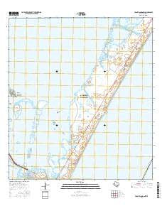
~ Crane Islands NW TX topo map, 1:24000 scale, 7.5 X 7.5 Minute, 2016
Crane Islands NW, Texas, USGS topographic map dated 2016.
Includes geographic coordinates (latitude and longitude). This topographic map is suitable for hiking, camping, and exploring, or framing it as a wall map.
Printed on-demand using high resolution imagery, on heavy weight and acid free paper, or alternatively on a variety of synthetic materials.
Topos available on paper, Waterproof, Poly, or Tyvek. Usually shipping rolled, unless combined with other folded maps in one order.
- Product Number: USGS-7926607
- Free digital map download (high-resolution, GeoPDF): Crane Islands NW, Texas (file size: 22 MB)
- Map Size: please refer to the dimensions of the GeoPDF map above
- Weight (paper map): ca. 55 grams
- Map Type: POD USGS Topographic Map
- Map Series: US Topo
- Map Verison: Current
- Cell ID: 72672
- Datum: North American Datum of 1983
- Map Projection: Transverse Mercator
- Map Cell Name: Crane Islands NW
- Grid size: 7.5 X 7.5 Minute
- Date on map: 2016
- Map Scale: 1:24000
- Geographical region: Texas, United States
Neighboring Maps:
All neighboring USGS topo maps are available for sale online at a variety of scales.
Spatial coverage:
Topo map Crane Islands NW, Texas, covers the geographical area associated the following places:
- Crane Islands - Packery Channel Park - Dead Man Hole - Smithville Public Library - Mustang Island State Park - Newport Pass - Kates Hole - Wilsons Cut - Croaker Hole - Range A Front Light - Puenta Vista Marina - Land and Sea Marina - Demit Island - Marker 37 Marina - Boat Hole - Corpus Christi Pass - Corpus Christi Fire Department Station 16 - Mustang Island - Mustang Island Heliport - Fish Pass - The Coastway Marina - Grants Cove
- Map Area ID: AREA27.7527.625-97.25-97.125
- Northwest corner Lat/Long code: USGSNW27.75-97.25
- Northeast corner Lat/Long code: USGSNE27.75-97.125
- Southwest corner Lat/Long code: USGSSW27.625-97.25
- Southeast corner Lat/Long code: USGSSE27.625-97.125
- Northern map edge Latitude: 27.75
- Southern map edge Latitude: 27.625
- Western map edge Longitude: -97.25
- Eastern map edge Longitude: -97.125


