
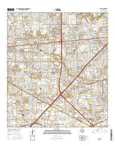
~ Alief TX topo map, 1:24000 scale, 7.5 X 7.5 Minute, 2016
Alief, Texas, USGS topographic map dated 2016.
Includes geographic coordinates (latitude and longitude). This topographic map is suitable for hiking, camping, and exploring, or framing it as a wall map.
Printed on-demand using high resolution imagery, on heavy weight and acid free paper, or alternatively on a variety of synthetic materials.
Topos available on paper, Waterproof, Poly, or Tyvek. Usually shipping rolled, unless combined with other folded maps in one order.
- Product Number: USGS-7902375
- Free digital map download (high-resolution, GeoPDF): Alief, Texas (file size: 29 MB)
- Map Size: please refer to the dimensions of the GeoPDF map above
- Weight (paper map): ca. 55 grams
- Map Type: POD USGS Topographic Map
- Map Series: US Topo
- Map Verison: Current
- Cell ID: 550
- Datum: North American Datum of 1983
- Map Projection: Transverse Mercator
- Map Cell Name: Alief
- Grid size: 7.5 X 7.5 Minute
- Date on map: 2016
- Map Scale: 1:24000
- Geographical region: Texas, United States
Neighboring Maps:
All neighboring USGS topo maps are available for sale online at a variety of scales.
Spatial coverage:
Topo map Alief, Texas, covers the geographical area associated the following places:
- Vacarro Manor - Townpark - Fondren Southwest - Braeburn Glen - Greenbrier Southwest - Westhampton Place - Rodeo Square - Missouri City Estates - Westpark Village - West Crest - Leewood West - Pheasant Run - Commerce Park - Northfield - Jeanetta - Glenshannon - Beechnut Crossing - Park Glen West - Rivercrest - Sharpstown - Gessport - Northbrook - Fondren Grove - Brays Village East - Catalina Village - Southwood Place - Oak Harbor - Alief - Covington West - Grove West - Main Street Gardens - The Oaks of Woodlake - Ashford Park - Two Worlds - Meadows Place - Bellaire West - Ashford Village - Fondren Center
- Map Area ID: AREA29.7529.625-95.625-95.5
- Northwest corner Lat/Long code: USGSNW29.75-95.625
- Northeast corner Lat/Long code: USGSNE29.75-95.5
- Southwest corner Lat/Long code: USGSSW29.625-95.625
- Southeast corner Lat/Long code: USGSSE29.625-95.5
- Northern map edge Latitude: 29.75
- Southern map edge Latitude: 29.625
- Western map edge Longitude: -95.625
- Eastern map edge Longitude: -95.5


