
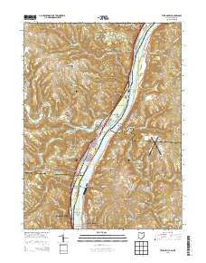
~ Tiltonsville OH topo map, 1:24000 scale, 7.5 X 7.5 Minute, Historical, 2013
Tiltonsville, Ohio, USGS topographic map dated 2013.
Includes geographic coordinates (latitude and longitude). This topographic map is suitable for hiking, camping, and exploring, or framing it as a wall map.
Printed on-demand using high resolution imagery, on heavy weight and acid free paper, or alternatively on a variety of synthetic materials.
Topos available on paper, Waterproof, Poly, or Tyvek. Usually shipping rolled, unless combined with other folded maps in one order.
- Product Number: USGS-7829883
- Free digital map download (high-resolution, GeoPDF): Tiltonsville, Ohio (file size: 37 MB)
- Map Size: please refer to the dimensions of the GeoPDF map above
- Weight (paper map): ca. 55 grams
- Map Type: POD USGS Topographic Map
- Map Series: US Topo
- Map Verison: Historical
- Cell ID: 45132
- Datum: North American Datum of 1983
- Map Projection: Transverse Mercator
- Map Cell Name: Tiltonsville
- Grid size: 7.5 X 7.5 Minute
- Date on map: 2013
- Map Scale: 1:24000
- Geographical region: Ohio, United States
Neighboring Maps:
All neighboring USGS topo maps are available for sale online at a variety of scales.
Spatial coverage:
Topo map Tiltonsville, Ohio, covers the geographical area associated the following places:
- Glenndale (historical) - Short Creek - Beech Bottom - Hopewell - Jug Run - Shannon (historical) - Wilson (historical) - Connorville - Bowman (historical) - Grandview Heights - Clearview - Rayland - Windsor Heights - Connor - Tiltonsville - Pettit Heights - Power - Glen Robbins - Betty Zane - Salt Run - Willow Springs (historical) - Jackson Heights - Rush Run - Yorkville - Upland Heights - Highland City - Glen Run - Stringer - Warrenton
- Map Area ID: AREA40.2540.125-80.75-80.625
- Northwest corner Lat/Long code: USGSNW40.25-80.75
- Northeast corner Lat/Long code: USGSNE40.25-80.625
- Southwest corner Lat/Long code: USGSSW40.125-80.75
- Southeast corner Lat/Long code: USGSSE40.125-80.625
- Northern map edge Latitude: 40.25
- Southern map edge Latitude: 40.125
- Western map edge Longitude: -80.75
- Eastern map edge Longitude: -80.625


