
~ North Canton OH topo map, 1:24000 scale, 7.5 X 7.5 Minute, Historical, 2013
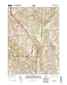
North Canton, Ohio, USGS topographic map dated 2013.
Includes geographic coordinates (latitude and longitude). This topographic map is suitable for hiking, camping, and exploring, or framing it as a wall map.
Printed on-demand using high resolution imagery, on heavy weight and acid free paper, or alternatively on a variety of synthetic materials.
Topos available on paper, Waterproof, Poly, or Tyvek. Usually shipping rolled, unless combined with other folded maps in one order.
- Product Number: USGS-7823288
- Free digital map download (high-resolution, GeoPDF): North Canton, Ohio (file size: 36 MB)
- Map Size: please refer to the dimensions of the GeoPDF map above
- Weight (paper map): ca. 55 grams
- Map Type: POD USGS Topographic Map
- Map Series: US Topo
- Map Verison: Historical
- Cell ID: 32332
- Datum: North American Datum of 1983
- Map Projection: Transverse Mercator
- Map Cell Name: North Canton
- Grid size: 7.5 X 7.5 Minute
- Date on map: 2013
- Map Scale: 1:24000
- Geographical region: Ohio, United States
Neighboring Maps:
All neighboring USGS topo maps are available for sale online at a variety of scales.
Spatial coverage:
Topo map North Canton, Ohio, covers the geographical area associated the following places:
- Paddington Woods - Mayfair East - Estates At Meadow Wood - Mayfair Estates - Mount Pleasant Estates - Millheim - Chenoweth Estates - Stratford Green At Mayfair - Lawnfield Estates - Stoney Creek Estates - Green Highlands - Arlington Knolls - Walnut Hills - Imrek Acres - Lakes Of Green - Rolling Greens - McChesney Acres - Uniontown - Evergreen Mobile Park - Bingo Estates - Greenfield Farms - Pressler Heights - Powell Subdivision - Mayfair Heights - Park Creek Estates - Lindale Heights - Tower Terrace - Springview Estates - Kimberly Valley - North Canton - Raintree Estates - Royal Mobile Park - Robinwood Estates - Greenwood Commons - The Highlands At Green - Avon Mobile Home Park - Brookwood Estates - Forest Lake Estates - Hidden Trail Estates - Green - Hyde Park - Marchand (historical) - Greensburg Woodlands - Myersville - Meadow Wood - Green Meadows Estates - Fox Run Meadows - McDonaldsville - Aultman - Kungle Heights - Ann Marie Estates - Saullos Acres - East Liberty - Lake Slagle - Park Ridge Estates - High Tower Estates - Mayfield Mobile Home Park - Charleston Place - Fox Ridge Estates - Mount Pleasant - Mystic Pointe - Greentown - Greensburg - Maces Mobile Estates - Villages At Meadow Wood - Finley Homesites - Springhill - Deer Pines Estates - Rolling Greens Estates - McChesney Meadows - Beechtree Estates - Arcadian Heights - Greenbrook Estates
- Map Area ID: AREA4140.875-81.5-81.375
- Northwest corner Lat/Long code: USGSNW41-81.5
- Northeast corner Lat/Long code: USGSNE41-81.375
- Southwest corner Lat/Long code: USGSSW40.875-81.5
- Southeast corner Lat/Long code: USGSSE40.875-81.375
- Northern map edge Latitude: 41
- Southern map edge Latitude: 40.875
- Western map edge Longitude: -81.5
- Eastern map edge Longitude: -81.375


