
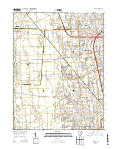
~ Hilliard OH topo map, 1:24000 scale, 7.5 X 7.5 Minute, Historical, 2013
Hilliard, Ohio, USGS topographic map dated 2013.
Includes geographic coordinates (latitude and longitude). This topographic map is suitable for hiking, camping, and exploring, or framing it as a wall map.
Printed on-demand using high resolution imagery, on heavy weight and acid free paper, or alternatively on a variety of synthetic materials.
Topos available on paper, Waterproof, Poly, or Tyvek. Usually shipping rolled, unless combined with other folded maps in one order.
- Product Number: USGS-7822124
- Free digital map download (high-resolution, GeoPDF): Hilliard, Ohio (file size: 30 MB)
- Map Size: please refer to the dimensions of the GeoPDF map above
- Weight (paper map): ca. 55 grams
- Map Type: POD USGS Topographic Map
- Map Series: US Topo
- Map Verison: Historical
- Cell ID: 20465
- Datum: North American Datum of 1983
- Map Projection: Transverse Mercator
- Map Cell Name: Hilliard
- Grid size: 7.5 X 7.5 Minute
- Date on map: 2013
- Map Scale: 1:24000
- Geographical region: Ohio, United States
Neighboring Maps:
All neighboring USGS topo maps are available for sale online at a variety of scales.
Spatial coverage:
Topo map Hilliard, Ohio, covers the geographical area associated the following places:
- Brookfield - Hampton Oaks - Heritage Creek - Abbey Chase - Estates At Hoffman Farms - Hyde Park - Darby Glen - Anderson Meadows - Britton Farms - Carrington Place - Amlin - Lakewood - Cross Creek - Richlanne Acres - Hayden Run Village - The Suburbans Mobile Home Park - Heritage Farms - Coventry Manor - Brittany Oaks - Hilliard - Hilliard Run - Hoffman Farms - Oak Run - Heather Ridge - Copperwood - Avery Estates - Western Lakes - Hampton Reserve - Bayberry Creek - Lamb Corners - Hilliard Heights - Brookbend - Hayden - Silver Springs - Sandy Corners - Mudsock - Westwind - Westbriar - Westbrooke Park - Ashleigh Village - Carriage Run - Dorset Glen - Luxair - Kileville - Heritage Lakes
- Map Area ID: AREA40.12540-83.25-83.125
- Northwest corner Lat/Long code: USGSNW40.125-83.25
- Northeast corner Lat/Long code: USGSNE40.125-83.125
- Southwest corner Lat/Long code: USGSSW40-83.25
- Southeast corner Lat/Long code: USGSSE40-83.125
- Northern map edge Latitude: 40.125
- Southern map edge Latitude: 40
- Western map edge Longitude: -83.25
- Eastern map edge Longitude: -83.125


