
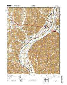
~ Gallipolis OH topo map, 1:24000 scale, 7.5 X 7.5 Minute, Historical, 2013
Gallipolis, Ohio, USGS topographic map dated 2013.
Includes geographic coordinates (latitude and longitude). This topographic map is suitable for hiking, camping, and exploring, or framing it as a wall map.
Printed on-demand using high resolution imagery, on heavy weight and acid free paper, or alternatively on a variety of synthetic materials.
Topos available on paper, Waterproof, Poly, or Tyvek. Usually shipping rolled, unless combined with other folded maps in one order.
- Product Number: USGS-7822036
- Free digital map download (high-resolution, GeoPDF): Gallipolis, Ohio (file size: 41 MB)
- Map Size: please refer to the dimensions of the GeoPDF map above
- Weight (paper map): ca. 55 grams
- Map Type: POD USGS Topographic Map
- Map Series: US Topo
- Map Verison: Historical
- Cell ID: 16710
- Datum: North American Datum of 1983
- Map Projection: Transverse Mercator
- Map Cell Name: Gallipolis
- Grid size: 7.5 X 7.5 Minute
- Date on map: 2013
- Map Scale: 1:24000
- Geographical region: Ohio, United States
Neighboring Maps:
All neighboring USGS topo maps are available for sale online at a variety of scales.
Spatial coverage:
Topo map Gallipolis, Ohio, covers the geographical area associated the following places:
- Wyoma - Spring Dale Subdivision - Hilltop Subdivision - Preston Subdivision - Hedgewood - Iva Dale Subdivision - Hawk Subdivision - Halliday Heights - Westbrook Village - Mapleshade - Orchard Hill - Beale - Willow Woods - Redmond - Heights - Lawnview - Gilmore Heights - Point Pleasant - Gallipolis - Mount Zion Subdivision - Meadow Look - Town and Country Estates - Gallipolis - Mills - Gallipolis Ferry - Henderson - Plantz Subdivision - Hanersville - Maxatawney Subdivision - Evans Heights - Sanders Subdivision - Pleasant Valley Estates - Grandview Estates - Mills Village - Cook Subdivision - Kanauga - Green Acres - Clipper Mills
- Map Area ID: AREA38.87538.75-82.25-82.125
- Northwest corner Lat/Long code: USGSNW38.875-82.25
- Northeast corner Lat/Long code: USGSNE38.875-82.125
- Southwest corner Lat/Long code: USGSSW38.75-82.25
- Southeast corner Lat/Long code: USGSSE38.75-82.125
- Northern map edge Latitude: 38.875
- Southern map edge Latitude: 38.75
- Western map edge Longitude: -82.25
- Eastern map edge Longitude: -82.125


