
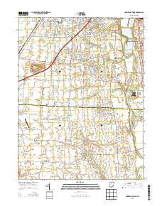
~ Commercial Point OH topo map, 1:24000 scale, 7.5 X 7.5 Minute, Historical, 2013
Commercial Point, Ohio, USGS topographic map dated 2013.
Includes geographic coordinates (latitude and longitude). This topographic map is suitable for hiking, camping, and exploring, or framing it as a wall map.
Printed on-demand using high resolution imagery, on heavy weight and acid free paper, or alternatively on a variety of synthetic materials.
Topos available on paper, Waterproof, Poly, or Tyvek. Usually shipping rolled, unless combined with other folded maps in one order.
- Product Number: USGS-7821794
- Free digital map download (high-resolution, GeoPDF): Commercial Point, Ohio (file size: 28 MB)
- Map Size: please refer to the dimensions of the GeoPDF map above
- Weight (paper map): ca. 55 grams
- Map Type: POD USGS Topographic Map
- Map Series: US Topo
- Map Verison: Historical
- Cell ID: 9766
- Datum: North American Datum of 1983
- Map Projection: Transverse Mercator
- Map Cell Name: Commercial Point
- Grid size: 7.5 X 7.5 Minute
- Date on map: 2013
- Map Scale: 1:24000
- Geographical region: Ohio, United States
Neighboring Maps:
All neighboring USGS topo maps are available for sale online at a variety of scales.
Spatial coverage:
Topo map Commercial Point, Ohio, covers the geographical area associated the following places:
- Ridpath (historical) - Holton Run - Claybrooke Crossings - Indian Trails - Meadow Grove East - Chestnut Farms - Mayfair Park - Village At Scioto Meadows - Quail Creek - Castle Farms - Meadow Grove Estates - Hennigans Grove - Autumn Grove - Commercial Point - Hawthorne Woods - Ledgestone At Indian Trails - Briarwood Hills - Keller Farm East - Creekside - Meadow Grove - Shadeville - Meadow Grove South - Matville - Hoover Crossing - Scioto Meadows - Woodfield Oaks - Landings At Quail Creek - Hoover Park - Margies Cove - Ravines At Quail Creek - Grant Run Estates - Zuber (historical) - Willows At Quail Creek - Keller Farm - Haughn Glen - The Crossing At Grants Run - Grove City Country Club
- Map Area ID: AREA39.87539.75-83.125-83
- Northwest corner Lat/Long code: USGSNW39.875-83.125
- Northeast corner Lat/Long code: USGSNE39.875-83
- Southwest corner Lat/Long code: USGSSW39.75-83.125
- Southeast corner Lat/Long code: USGSSE39.75-83
- Northern map edge Latitude: 39.875
- Southern map edge Latitude: 39.75
- Western map edge Longitude: -83.125
- Eastern map edge Longitude: -83


