
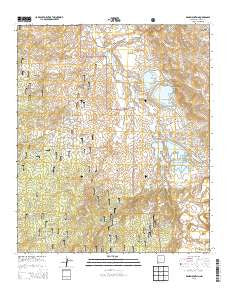
~ Wind Mountain NM topo map, 1:24000 scale, 7.5 X 7.5 Minute, Historical, 2013
Wind Mountain, New Mexico, USGS topographic map dated 2013.
Includes geographic coordinates (latitude and longitude). This topographic map is suitable for hiking, camping, and exploring, or framing it as a wall map.
Printed on-demand using high resolution imagery, on heavy weight and acid free paper, or alternatively on a variety of synthetic materials.
Topos available on paper, Waterproof, Poly, or Tyvek. Usually shipping rolled, unless combined with other folded maps in one order.
- Product Number: USGS-7796802
- Free digital map download (high-resolution, GeoPDF): Wind Mountain, New Mexico (file size: 40 MB)
- Map Size: please refer to the dimensions of the GeoPDF map above
- Weight (paper map): ca. 55 grams
- Map Type: POD USGS Topographic Map
- Map Series: US Topo
- Map Verison: Historical
- Cell ID: 49395
- Datum: North American Datum of 1983
- Map Projection: Transverse Mercator
- Map Cell Name: Wind Mountain
- Grid size: 7.5 X 7.5 Minute
- Date on map: 2013
- Map Scale: 1:24000
- Geographical region: New Mexico, United States
Neighboring Maps:
All neighboring USGS topo maps are available for sale online at a variety of scales.
Spatial coverage:
Topo map Wind Mountain, New Mexico, covers the geographical area associated the following places:
- Whitewater Tank - Deadman Canyon - Copper Mountain (historical) - Ace High Fluorspar Deposit - Wind Mountain - Turquoise Mine - Beaseley Property - The Pines - Thompson Ranch - National Copper Company Mine - Ridout Ranch - Negro Canyon - Old Ranger Station Windmill - C F Canyon - Grant County - Silver Dale Corral - Gardner Prospect - 10039 Water Well - Ohio Mine - Turquoise Tank - Evening Star Claim - Southern Star Deposits - Silver Dale Tank - Bolton Mine - McCain Spring - Burro Chief Mine (historical) - California Gulch - Silver King Mine - Phelps Dodge Tailing Dam Number Two - Willow Creek - Kaufman Ranch - Wind Canyon - Beaumout Mine - Eagle Point - Sawmill Canyon - Phelps Dodge Tailings Dam Number One - Phelps Dodge Tailing Dam Number Three - Sampson Mine (historical) - Osmer Gold Mine - Section 22 Deposit - Phelps-Dodge Open Pit Copper Mine - Liberty Bell Mine - C F Spring - Silver Dale Windmill - Silver Dale Spring - Redrock Tank - California Gulch Prospect - Saint Louis Mine (historical) - Woodward Ranch - Sugarloaf Mountain - Sandmill Windmill - Granite Windmill - Maverick Canyon - Silver Dale Canyon - Nellie Bly Mine - Iron Gulch - Shrine Mine - Missouri Girl Mine - Whitewater Canyon - Redrock Canyon - Camp Creek Tank - C F Ranch - Siphon Spring - Fleming Ranch
- Map Area ID: AREA32.7532.625-108.5-108.375
- Northwest corner Lat/Long code: USGSNW32.75-108.5
- Northeast corner Lat/Long code: USGSNE32.75-108.375
- Southwest corner Lat/Long code: USGSSW32.625-108.5
- Southeast corner Lat/Long code: USGSSE32.625-108.375
- Northern map edge Latitude: 32.75
- Southern map edge Latitude: 32.625
- Western map edge Longitude: -108.5
- Eastern map edge Longitude: -108.375


