
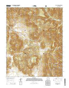
~ Valle Toledo NM topo map, 1:24000 scale, 7.5 X 7.5 Minute, Historical, 2013
Valle Toledo, New Mexico, USGS topographic map dated 2013.
Includes geographic coordinates (latitude and longitude). This topographic map is suitable for hiking, camping, and exploring, or framing it as a wall map.
Printed on-demand using high resolution imagery, on heavy weight and acid free paper, or alternatively on a variety of synthetic materials.
Topos available on paper, Waterproof, Poly, or Tyvek. Usually shipping rolled, unless combined with other folded maps in one order.
- Product Number: USGS-7796590
- Free digital map download (high-resolution, GeoPDF): Valle Toledo, New Mexico (file size: 38 MB)
- Map Size: please refer to the dimensions of the GeoPDF map above
- Weight (paper map): ca. 55 grams
- Map Type: POD USGS Topographic Map
- Map Series: US Topo
- Map Verison: Historical
- Cell ID: 46550
- Datum: North American Datum of 1983
- Map Projection: Transverse Mercator
- Map Cell Name: Valle Toledo
- Grid size: 7.5 X 7.5 Minute
- Date on map: 2013
- Map Scale: 1:24000
- Geographical region: New Mexico, United States
Neighboring Maps:
All neighboring USGS topo maps are available for sale online at a variety of scales.
Spatial coverage:
Topo map Valle Toledo, New Mexico, covers the geographical area associated the following places:
- Rito de los Indios - Cerros del Abrigo - Shell Mountain - Puerto de Abrigo - Valle de los Posos - Pajarito Mountain - Cerro Toledo - Baca Location Number One - Valle Jaramillo - Turkey Creek - KRBL-FM (Los Alamos) - Valle Toledo - Cerro Rubio - Cerro del Medio - Rincon de los Soldados - Sierra de los Valles - Cerro Piñon - Cañada Bonita - Puerta de Trasquilar - Cerros de los Posos - Pajarito Mountain Ski Area - Sierra de Toledo - Pajarito Canyon Trail - Turkey Ridge - KNLA-FM (White Rock) - KNYN-FM (Santa Fe) - Cerro Santa Rosa - Turkey Canyon - Camp May Recreation Site - Indian Point
- Map Area ID: AREA3635.875-106.5-106.375
- Northwest corner Lat/Long code: USGSNW36-106.5
- Northeast corner Lat/Long code: USGSNE36-106.375
- Southwest corner Lat/Long code: USGSSW35.875-106.5
- Southeast corner Lat/Long code: USGSSE35.875-106.375
- Northern map edge Latitude: 36
- Southern map edge Latitude: 35.875
- Western map edge Longitude: -106.5
- Eastern map edge Longitude: -106.375


