
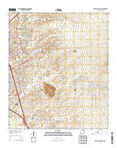
~ Tortugas Mountain NM topo map, 1:24000 scale, 7.5 X 7.5 Minute, Historical, 2013
Tortugas Mountain, New Mexico, USGS topographic map dated 2013.
Includes geographic coordinates (latitude and longitude). This topographic map is suitable for hiking, camping, and exploring, or framing it as a wall map.
Printed on-demand using high resolution imagery, on heavy weight and acid free paper, or alternatively on a variety of synthetic materials.
Topos available on paper, Waterproof, Poly, or Tyvek. Usually shipping rolled, unless combined with other folded maps in one order.
- Product Number: USGS-7796182
- Free digital map download (high-resolution, GeoPDF): Tortugas Mountain, New Mexico (file size: 36 MB)
- Map Size: please refer to the dimensions of the GeoPDF map above
- Weight (paper map): ca. 55 grams
- Map Type: POD USGS Topographic Map
- Map Series: US Topo
- Map Verison: Historical
- Cell ID: 45462
- Datum: North American Datum of 1983
- Map Projection: Transverse Mercator
- Map Cell Name: Tortugas Mountain
- Grid size: 7.5 X 7.5 Minute
- Date on map: 2013
- Map Scale: 1:24000
- Geographical region: New Mexico, United States
Neighboring Maps:
All neighboring USGS topo maps are available for sale online at a variety of scales.
Spatial coverage:
Topo map Tortugas Mountain, New Mexico, covers the geographical area associated the following places:
- Manganese Number Two Mine - Tortugas Mine - Las Alturas Estates Wells - New Mexico State Police District 4 Las Cruces - A Mountain-Inman Pit - Fillmore (historical) - Hoffer MN Prospect - Memorial General Hospital Helistop - Well 17 Water Well - Rehabilitation Hospital of Southern New Mexico - Las Alturas Volunteer Fire Department Talavera Substation - Burn Pit - 10096 Water Well - City Water Well 9 - Memorial Medical Center - North Fork Las Cruces Arroyo - New Mexico State University Fire and Emergency Services - Manganese Number One Mine - Alameda Dam - Jones - Santiago - Triangle Placer Mine - NMSU 4 Water Well - Tortugas Mountain - South Fork Las Cruces Arroyo - NMSU 9 Water Well - Cox Pit Number Two - SK Standard Mine - Las Alturas Fire Department - City 24 Water Well - Tortugas Arroyo - Fillmore Site Number One Dam - Little Dam - MountainView Regional Medical Center - Mesilla Valley Mall - Advanced Care Hospital of Southern New Mexico - Tortugas Cemetery - Las Cruces Fire Department Station 4 - NMSU 3 Water Well - Triangle Placer Minning Claim - South Fork Dam - University Park Census Designated Place - North Fork Dam - Tortugas Watershed Site Number Two Dam - Jesse Well - Las Cruces Division - Tortugas Site Number One Dam
- Map Area ID: AREA32.37532.25-106.75-106.625
- Northwest corner Lat/Long code: USGSNW32.375-106.75
- Northeast corner Lat/Long code: USGSNE32.375-106.625
- Southwest corner Lat/Long code: USGSSW32.25-106.75
- Southeast corner Lat/Long code: USGSSE32.25-106.625
- Northern map edge Latitude: 32.375
- Southern map edge Latitude: 32.25
- Western map edge Longitude: -106.75
- Eastern map edge Longitude: -106.625


