
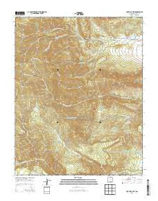
~ Tooth of Time NM topo map, 1:24000 scale, 7.5 X 7.5 Minute, Historical, 2013
Tooth of Time, New Mexico, USGS topographic map dated 2013.
Includes geographic coordinates (latitude and longitude). This topographic map is suitable for hiking, camping, and exploring, or framing it as a wall map.
Printed on-demand using high resolution imagery, on heavy weight and acid free paper, or alternatively on a variety of synthetic materials.
Topos available on paper, Waterproof, Poly, or Tyvek. Usually shipping rolled, unless combined with other folded maps in one order.
- Product Number: USGS-7796178
- Free digital map download (high-resolution, GeoPDF): Tooth of Time, New Mexico (file size: 35 MB)
- Map Size: please refer to the dimensions of the GeoPDF map above
- Weight (paper map): ca. 55 grams
- Map Type: POD USGS Topographic Map
- Map Series: US Topo
- Map Verison: Historical
- Cell ID: 45411
- Datum: North American Datum of 1983
- Map Projection: Transverse Mercator
- Map Cell Name: Tooth of Time
- Grid size: 7.5 X 7.5 Minute
- Date on map: 2013
- Map Scale: 1:24000
- Geographical region: New Mexico, United States
Neighboring Maps:
All neighboring USGS topo maps are available for sale online at a variety of scales.
Spatial coverage:
Topo map Tooth of Time, New Mexico, covers the geographical area associated the following places:
- Cimarroncito Reservoir Dam - Cimarroncito Camp - Ponderosa Camp - Cimarroncito Base Camp - Black Mountain - Old Abreu Camp - Cyphers Mine - South Fork Cimarroncito Creek - Cyphers Mine Camp - Clarks Fork Site Number 2 Dam - Lambert Mine Camp Site - Bear Creek - Phillips Junction - Rimrock Park Camp - Bear Canyon - North Fork Cimarroncito Creek - Rayado Peak - Ute Gulch - Cimarroncito Peak - Miners Park Camp - Comanche Pass - Cimarroncito Reservoir - Lookout Meadows Camp - Crater Lake Camp - Burn Peak - Bonito Creek - Aguila Camp - Lookout Peak - Grizzly Tooth - Buck Creek - Fowler Pass - Fowler Mesa - Jeff Creek - Window Rock - Urraca Dam - Beaubien Camp - Agua Fria Creek - Shaefers Peak - Lovers Leap Camp - Trail Peak - Lovers Leap - Stone Wall Pass - Bear Mountain - Fish Camp - Cathedral Rock - Bonito Cow Camp - Miners Park - Webster Pass - Middle Fork Cimarroncito Creek - Clarks Fork Trail Camp - Black Mountain Camp - Clarks Fork Creek - Hidden Valley - Bear Creek - Webster Dam - Apache Creek - Lower Bonito Camp - North Fork Urraca Camp - Cathedral Rock Campground - New Abreu Camp - Tooth of Time - Shaefers Peak - Bonito Peak - Beaver Ponds - Bear Cave Camp - Webster Reservoir
- Map Area ID: AREA36.536.375-105.125-105
- Northwest corner Lat/Long code: USGSNW36.5-105.125
- Northeast corner Lat/Long code: USGSNE36.5-105
- Southwest corner Lat/Long code: USGSSW36.375-105.125
- Southeast corner Lat/Long code: USGSSE36.375-105
- Northern map edge Latitude: 36.5
- Southern map edge Latitude: 36.375
- Western map edge Longitude: -105.125
- Eastern map edge Longitude: -105


