
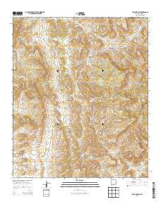
~ Sulphur Pass NM topo map, 1:24000 scale, 7.5 X 7.5 Minute, Historical, 2013
Sulphur Pass, New Mexico, USGS topographic map dated 2013.
Includes geographic coordinates (latitude and longitude). This topographic map is suitable for hiking, camping, and exploring, or framing it as a wall map.
Printed on-demand using high resolution imagery, on heavy weight and acid free paper, or alternatively on a variety of synthetic materials.
Topos available on paper, Waterproof, Poly, or Tyvek. Usually shipping rolled, unless combined with other folded maps in one order.
- Product Number: USGS-7795958
- Free digital map download (high-resolution, GeoPDF): Sulphur Pass, New Mexico (file size: 45 MB)
- Map Size: please refer to the dimensions of the GeoPDF map above
- Weight (paper map): ca. 55 grams
- Map Type: POD USGS Topographic Map
- Map Series: US Topo
- Map Verison: Historical
- Cell ID: 43695
- Datum: North American Datum of 1983
- Map Projection: Transverse Mercator
- Map Cell Name: Sulphur Pass
- Grid size: 7.5 X 7.5 Minute
- Date on map: 2013
- Map Scale: 1:24000
- Geographical region: New Mexico, United States
Neighboring Maps:
All neighboring USGS topo maps are available for sale online at a variety of scales.
Spatial coverage:
Topo map Sulphur Pass, New Mexico, covers the geographical area associated the following places:
- Hackberry Canyon - Cedar Spring - El Paso Canyon - Hackberry Spring (historical) - New Well (historical) - Upper Cottonwood Spring - Woolf Spring - Domijohn Canyon - Murray Well - Taylor Tank - Horse Camp Spring - Squaw Tit Canyon - Floyd Crockett Ranch (historical) - Tub Spring - White Spring - Buckhorn Spring - Lower Sulphur Spring - Woolf Ranch Headquarters (historical) - Domijohn Well - Big Mountain - Frank Crockett Ranch Headquarters - Pilot Knob - San Andres Mountains - Esque Spring (historical) - Ben Taylor Tank - Loma Vista - Holcomb Spring - Cottonwood Spring - Quemado Spring - Doe Spring - Sulphur Pass - North Richard Tank - Rock House Well - Buckhorn Canyon - Sulphur Spring - Walson Well - Richard Tank - Woolf Gap - Crocket Spring - Sulphur Flats - Dog Seep - Walson Gap
- Map Area ID: AREA33.12533-106.75-106.625
- Northwest corner Lat/Long code: USGSNW33.125-106.75
- Northeast corner Lat/Long code: USGSNE33.125-106.625
- Southwest corner Lat/Long code: USGSSW33-106.75
- Southeast corner Lat/Long code: USGSSE33-106.625
- Northern map edge Latitude: 33.125
- Southern map edge Latitude: 33
- Western map edge Longitude: -106.75
- Eastern map edge Longitude: -106.625


