
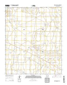
~ Simanola Valley NM topo map, 1:24000 scale, 7.5 X 7.5 Minute, Historical, 2013
Simanola Valley, New Mexico, USGS topographic map dated 2013.
Includes geographic coordinates (latitude and longitude). This topographic map is suitable for hiking, camping, and exploring, or framing it as a wall map.
Printed on-demand using high resolution imagery, on heavy weight and acid free paper, or alternatively on a variety of synthetic materials.
Topos available on paper, Waterproof, Poly, or Tyvek. Usually shipping rolled, unless combined with other folded maps in one order.
- Product Number: USGS-7795762
- Free digital map download (high-resolution, GeoPDF): Simanola Valley, New Mexico (file size: 25 MB)
- Map Size: please refer to the dimensions of the GeoPDF map above
- Weight (paper map): ca. 55 grams
- Map Type: POD USGS Topographic Map
- Map Series: US Topo
- Map Verison: Historical
- Cell ID: 41428
- Datum: North American Datum of 1983
- Map Projection: Transverse Mercator
- Map Cell Name: Simanola Valley
- Grid size: 7.5 X 7.5 Minute
- Date on map: 2013
- Map Scale: 1:24000
- Geographical region: New Mexico, United States
Neighboring Maps:
All neighboring USGS topo maps are available for sale online at a variety of scales.
Spatial coverage:
Topo map Simanola Valley, New Mexico, covers the geographical area associated the following places:
- 10696 Water Well - Rob Windmill - 10008 Water Well - Four Lakes Area - East Windmill - East Horse Windmill - Hill Pasture Bottom Windmill - Dripper Windmill - 10694 Water Well - Tatum Division - Badger Windmill - Northwest Windmill - Middle Pasture Windmill - 12782 Water Well - 10780 Water Well - 12707 Water Well - Ninemile Windmill - Well Eightmile Windmill - Jones Ranch - 10692 Water Well - 13392 Water Well - South Pasture Windmill - 10693 Water Well - 10778 Water Well - 10779 Water Well - Hill Pasture Middle Windmill - West Girl Windmill - 12705 Water Well - Ranger Lake Oil Field - 10687 Water Well - Shipper Pen Windmill - 13391 Water Well - 10702 Water Well - Middle Lake - North Windmill - 13408 Water Well - North Pasture Windmill - 10754 Water Well - 10691 Water Well - 10695 Water Well - 12706 Water Well - South Ninemile Windmill - Hill Pasture Top Windmill - 10686 Water Well - 10777 Water Well - 10701 Water Well - 10689 Water Well - House Lake
- Map Area ID: AREA33.37533.25-103.5-103.375
- Northwest corner Lat/Long code: USGSNW33.375-103.5
- Northeast corner Lat/Long code: USGSNE33.375-103.375
- Southwest corner Lat/Long code: USGSSW33.25-103.5
- Southeast corner Lat/Long code: USGSSE33.25-103.375
- Northern map edge Latitude: 33.375
- Southern map edge Latitude: 33.25
- Western map edge Longitude: -103.5
- Eastern map edge Longitude: -103.375


