
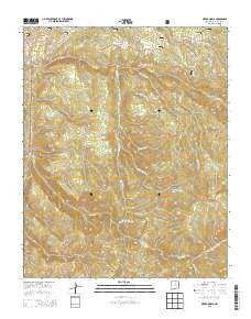
~ Sierra Mosca NM topo map, 1:24000 scale, 7.5 X 7.5 Minute, Historical, 2013
Sierra Mosca, New Mexico, USGS topographic map dated 2013.
Includes geographic coordinates (latitude and longitude). This topographic map is suitable for hiking, camping, and exploring, or framing it as a wall map.
Printed on-demand using high resolution imagery, on heavy weight and acid free paper, or alternatively on a variety of synthetic materials.
Topos available on paper, Waterproof, Poly, or Tyvek. Usually shipping rolled, unless combined with other folded maps in one order.
- Product Number: USGS-7795736
- Free digital map download (high-resolution, GeoPDF): Sierra Mosca, New Mexico (file size: 40 MB)
- Map Size: please refer to the dimensions of the GeoPDF map above
- Weight (paper map): ca. 55 grams
- Map Type: POD USGS Topographic Map
- Map Series: US Topo
- Map Verison: Historical
- Cell ID: 41293
- Datum: North American Datum of 1983
- Map Projection: Transverse Mercator
- Map Cell Name: Sierra Mosca
- Grid size: 7.5 X 7.5 Minute
- Date on map: 2013
- Map Scale: 1:24000
- Geographical region: New Mexico, United States
Neighboring Maps:
All neighboring USGS topo maps are available for sale online at a variety of scales.
Spatial coverage:
Topo map Sierra Mosca, New Mexico, covers the geographical area associated the following places:
- Pajarita Cabin (historical) - Rio Frijoles Trail - Sierra Mosca Trick Tank - Cañada de Amole - Rio Molino - Cañon del Oso - Rito con Agua - Agua Sarca Trail - Rio Capulin Trail - Agua Sarca Cabin (historical) - Panchuela West - Medio Dia Trail - Rito Frijoles - Santa Rita Beryl Prospect - Cañon Navajo - Agua Sarca - Chupaderos Creek - Rito Gallina - Puertecito Creek - Mesa Borrego - Rio Molino Trail - Cienega Redonda - Rito sin Agua - Sarca Spring - Sierra Mosca - Borrego Mesa Campground - Rito Quemado
- Map Area ID: AREA3635.875-105.875-105.75
- Northwest corner Lat/Long code: USGSNW36-105.875
- Northeast corner Lat/Long code: USGSNE36-105.75
- Southwest corner Lat/Long code: USGSSW35.875-105.875
- Southeast corner Lat/Long code: USGSSE35.875-105.75
- Northern map edge Latitude: 36
- Southern map edge Latitude: 35.875
- Western map edge Longitude: -105.875
- Eastern map edge Longitude: -105.75


