
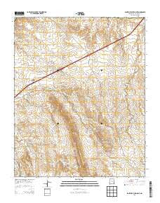
~ San Felipe Pueblo NE NM topo map, 1:24000 scale, 7.5 X 7.5 Minute, Historical, 2013
San Felipe Pueblo NE, New Mexico, USGS topographic map dated 2013.
Includes geographic coordinates (latitude and longitude). This topographic map is suitable for hiking, camping, and exploring, or framing it as a wall map.
Printed on-demand using high resolution imagery, on heavy weight and acid free paper, or alternatively on a variety of synthetic materials.
Topos available on paper, Waterproof, Poly, or Tyvek. Usually shipping rolled, unless combined with other folded maps in one order.
- Product Number: USGS-7795548
- Free digital map download (high-resolution, GeoPDF): San Felipe Pueblo NE, New Mexico (file size: 33 MB)
- Map Size: please refer to the dimensions of the GeoPDF map above
- Weight (paper map): ca. 55 grams
- Map Type: POD USGS Topographic Map
- Map Series: US Topo
- Map Verison: Historical
- Cell ID: 39617
- Datum: North American Datum of 1983
- Map Projection: Transverse Mercator
- Map Cell Name: San Felipe Pueblo NE
- Grid size: 7.5 X 7.5 Minute
- Date on map: 2013
- Map Scale: 1:24000
- Geographical region: New Mexico, United States
Neighboring Maps:
All neighboring USGS topo maps are available for sale online at a variety of scales.
Spatial coverage:
Topo map San Felipe Pueblo NE, New Mexico, covers the geographical area associated the following places:
- MGM Claims - 10025 Water Well - Rabac Claims - Pina Vititos Mine - Blackshare Ranch - San Felipe Pueblo/Santo Domingo Pueblo Joint-Use Area - 10010 Water Well - We Hope Claims - Mata Claims - Mormon Battalion Monument - Duke City Mine - Ace Claims - Blackshere Prospect - Ben Claims - Karavanos Prospect - San Felipe Pit - Dec Claims
- Map Area ID: AREA35.535.375-106.375-106.25
- Northwest corner Lat/Long code: USGSNW35.5-106.375
- Northeast corner Lat/Long code: USGSNE35.5-106.25
- Southwest corner Lat/Long code: USGSSW35.375-106.375
- Southeast corner Lat/Long code: USGSSE35.375-106.25
- Northern map edge Latitude: 35.5
- Southern map edge Latitude: 35.375
- Western map edge Longitude: -106.375
- Eastern map edge Longitude: -106.25


