
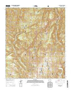
~ Saliz Pass NM topo map, 1:24000 scale, 7.5 X 7.5 Minute, Historical, 2013
Saliz Pass, New Mexico, USGS topographic map dated 2013.
Includes geographic coordinates (latitude and longitude). This topographic map is suitable for hiking, camping, and exploring, or framing it as a wall map.
Printed on-demand using high resolution imagery, on heavy weight and acid free paper, or alternatively on a variety of synthetic materials.
Topos available on paper, Waterproof, Poly, or Tyvek. Usually shipping rolled, unless combined with other folded maps in one order.
- Product Number: USGS-7795526
- Free digital map download (high-resolution, GeoPDF): Saliz Pass, New Mexico (file size: 40 MB)
- Map Size: please refer to the dimensions of the GeoPDF map above
- Weight (paper map): ca. 55 grams
- Map Type: POD USGS Topographic Map
- Map Series: US Topo
- Map Verison: Historical
- Cell ID: 39474
- Datum: North American Datum of 1983
- Map Projection: Transverse Mercator
- Map Cell Name: Saliz Pass
- Grid size: 7.5 X 7.5 Minute
- Date on map: 2013
- Map Scale: 1:24000
- Geographical region: New Mexico, United States
Neighboring Maps:
All neighboring USGS topo maps are available for sale online at a variety of scales.
Spatial coverage:
Topo map Saliz Pass, New Mexico, covers the geographical area associated the following places:
- Bear Canyon - Old Highway Tank - Saliz Pass - Bang Tail Canyon - Gordon Canyon - Tige Canyon - Cottonwood Campground - Javeling Tank - Upper Gut Ache Tank - Brushy Canyon Corral - L Kelly Ranch - Dangerous Park Canyon - Pueblo Park - Jones Canyon - Blue Range Wilderness - Saliz Corral - River Tank - Buckskin Canyon - Kelly Camp - Brushy Mountains - Pueblo Park Campground - Brushy Canyon Tank - Little Joe Tank - Pueblo Park Spring - Martinez Canyon - Pueblo Park Corral - Little Joe Trick Tank - Six Bar Tank - Ribbon Tank - Kelly Tank Number 2 - Chimney Rock Canyon - Gut Ache Corral - Lower Gut Ache Tank - Cottonwood Canyon - Brushy Well - Bear Canyon Corral - Saliz Hill - Lewis Tank - Line Gap Tank - Chimney Rock - Willies Tank - Serna Ranch - Willie Kelly Place - Kelly Tanks - Pup Canyon - Bisquit Tank - WS Corral - Saliz Mountain Tank - West Fork Pueblo Creek - Indian Peak Tank - Gut Ache Mesa - Martinez Ranch - Frying Pan Canyon
- Map Area ID: AREA33.62533.5-109-108.875
- Northwest corner Lat/Long code: USGSNW33.625-109
- Northeast corner Lat/Long code: USGSNE33.625-108.875
- Southwest corner Lat/Long code: USGSSW33.5-109
- Southeast corner Lat/Long code: USGSSE33.5-108.875
- Northern map edge Latitude: 33.625
- Southern map edge Latitude: 33.5
- Western map edge Longitude: -109
- Eastern map edge Longitude: -108.875


