
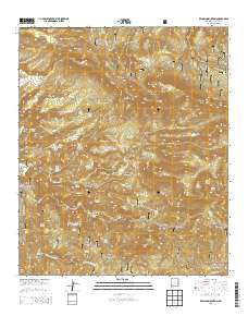
~ Reading Mountain NM topo map, 1:24000 scale, 7.5 X 7.5 Minute, Historical, 2013
Reading Mountain, New Mexico, USGS topographic map dated 2013.
Includes geographic coordinates (latitude and longitude). This topographic map is suitable for hiking, camping, and exploring, or framing it as a wall map.
Printed on-demand using high resolution imagery, on heavy weight and acid free paper, or alternatively on a variety of synthetic materials.
Topos available on paper, Waterproof, Poly, or Tyvek. Usually shipping rolled, unless combined with other folded maps in one order.
- Product Number: USGS-7795200
- Free digital map download (high-resolution, GeoPDF): Reading Mountain, New Mexico (file size: 39 MB)
- Map Size: please refer to the dimensions of the GeoPDF map above
- Weight (paper map): ca. 55 grams
- Map Type: POD USGS Topographic Map
- Map Series: US Topo
- Map Verison: Historical
- Cell ID: 37246
- Datum: North American Datum of 1983
- Map Projection: Transverse Mercator
- Map Cell Name: Reading Mountain
- Grid size: 7.5 X 7.5 Minute
- Date on map: 2013
- Map Scale: 1:24000
- Geographical region: New Mexico, United States
Neighboring Maps:
All neighboring USGS topo maps are available for sale online at a variety of scales.
Spatial coverage:
Topo map Reading Mountain, New Mexico, covers the geographical area associated the following places:
- Devils Garden - Pipeline Spring - Reading Mountain - Bobtail Mesa - Little Pipe Spring - Holmon Spring - Bear Creek Spring - Arroyo Rico - Salt Mesa Spring - Cave Spring Canyon - Allen Spring - Goat Canyon - Big Trap Spring - Little Pipeline Spring - Webb Gulch - Moore Tank - Moore Canyon - Snow Creek Cabin - Sycamore Spring - Lower Cave Creek Spring - Tadpole Lake - Walnut Creek - Homon Spring - Clark Spring - Pipeline Spring - Tadpole Ridge - Sycamore Creek - Reading Mesa - Wilson Creek - Turkey Flat - Pipeline Spring - North Fork Walnut Creek - Snow Creek Tank - Hidden Spring - Cherry Creek Canyon - Cooley Spring - Quartzite Tank - Salt Mesa - Cherry Creek - Fenceline Spring - Salt Mesa Spring - Codey Tank - Snow Creek Trail - Preachers Point - Long Gulch - Cave Spring - Buckwood Mesa - Sawmill Spring - Holman Spring - Moore Spring - Upper Cave Creek Spring - Horseshoe Bend - Juniper Hill - Walnut Creek Spring - A Four Mountain - Cooley Tank - Turkey Canyon - Hells Canyon Spring - Snow Creek Spring - Cave Canyon
- Map Area ID: AREA3332.875-108.375-108.25
- Northwest corner Lat/Long code: USGSNW33-108.375
- Northeast corner Lat/Long code: USGSNE33-108.25
- Southwest corner Lat/Long code: USGSSW32.875-108.375
- Southeast corner Lat/Long code: USGSSE32.875-108.25
- Northern map edge Latitude: 33
- Southern map edge Latitude: 32.875
- Western map edge Longitude: -108.375
- Eastern map edge Longitude: -108.25


