
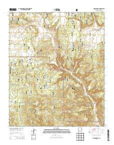
~ Queens Head NM topo map, 1:24000 scale, 7.5 X 7.5 Minute, Historical, 2013
Queens Head, New Mexico, USGS topographic map dated 2013.
Includes geographic coordinates (latitude and longitude). This topographic map is suitable for hiking, camping, and exploring, or framing it as a wall map.
Printed on-demand using high resolution imagery, on heavy weight and acid free paper, or alternatively on a variety of synthetic materials.
Topos available on paper, Waterproof, Poly, or Tyvek. Usually shipping rolled, unless combined with other folded maps in one order.
- Product Number: USGS-7795156
- Free digital map download (high-resolution, GeoPDF): Queens Head, New Mexico (file size: 38 MB)
- Map Size: please refer to the dimensions of the GeoPDF map above
- Weight (paper map): ca. 55 grams
- Map Type: POD USGS Topographic Map
- Map Series: US Topo
- Map Verison: Historical
- Cell ID: 36776
- Datum: North American Datum of 1983
- Map Projection: Transverse Mercator
- Map Cell Name: Queens Head
- Grid size: 7.5 X 7.5 Minute
- Date on map: 2013
- Map Scale: 1:24000
- Geographical region: New Mexico, United States
Neighboring Maps:
All neighboring USGS topo maps are available for sale online at a variety of scales.
Spatial coverage:
Topo map Queens Head, New Mexico, covers the geographical area associated the following places:
- Bear Canyon Tank Number Two - Oak Springs - Piney Park Tank Number 1 - Apache Creek Deaf Ranch - Lee Russell Tank - Mule Spring - Queens Head - Fitzgerald Cienega - Gann Tank - Dry Lake - Wild Horse Tank - Piney Park Tank - Deep Canyon Tank - Gann Windmill - Sawmill Canyon - Piney Park Canyon - East Camp Tank - Yankee Spring - Deep Canyon - Bear Canyon Tank - Jewett Work Center - Elk Horn Park - Jewett Gap Canyon - Negrohead Butte - Piney Park - Lower Water Spring - Turkey Park Tank - Elk Horn Tank - Red Windmill - Preston Tank - Wilson Canyon Tank Number 1 - Lawson Canyon - Bear Canyon - Hastings Tank - Whiskey Creek - Wilson Canyon Tank Number 2 - Kerr Canyon - Upper Sawmill Tank - Turkey Park - Kerr Spring - Daisy Gulch - East Camp Windmill - Hardcastle Canyon - Kerr Tank - Headwater Canyon - Quemado Ranger District - Yankee Gulch - Lee Russell Canyon - Schoolhouse Spring - Dry Lakes - Park Tank - Schoolhouse Canyon - Lee Russell Spring
- Map Area ID: AREA3433.875-108.75-108.625
- Northwest corner Lat/Long code: USGSNW34-108.75
- Northeast corner Lat/Long code: USGSNE34-108.625
- Southwest corner Lat/Long code: USGSSW33.875-108.75
- Southeast corner Lat/Long code: USGSSE33.875-108.625
- Northern map edge Latitude: 34
- Southern map edge Latitude: 33.875
- Western map edge Longitude: -108.75
- Eastern map edge Longitude: -108.625


