
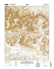
~ Casamero Lake NM topo map, 1:24000 scale, 7.5 X 7.5 Minute, Historical, 2013
Casamero Lake, New Mexico, USGS topographic map dated 2013.
Includes geographic coordinates (latitude and longitude). This topographic map is suitable for hiking, camping, and exploring, or framing it as a wall map.
Printed on-demand using high resolution imagery, on heavy weight and acid free paper, or alternatively on a variety of synthetic materials.
Topos available on paper, Waterproof, Poly, or Tyvek. Usually shipping rolled, unless combined with other folded maps in one order.
- Product Number: USGS-7791183
- Free digital map download (high-resolution, GeoPDF): Casamero Lake, New Mexico (file size: 38 MB)
- Map Size: please refer to the dimensions of the GeoPDF map above
- Weight (paper map): ca. 55 grams
- Map Type: POD USGS Topographic Map
- Map Series: US Topo
- Map Verison: Historical
- Cell ID: 7494
- Datum: North American Datum of 1983
- Map Projection: Transverse Mercator
- Map Cell Name: Casamero Lake
- Grid size: 7.5 X 7.5 Minute
- Date on map: 2013
- Map Scale: 1:24000
- Geographical region: New Mexico, United States
Neighboring Maps:
All neighboring USGS topo maps are available for sale online at a variety of scales.
Spatial coverage:
Topo map Casamero Lake, New Mexico, covers the geographical area associated the following places:
- 10018 Water Well - Rocky Point - Uranium Deposit - 16T-597 Water Well - Big Point - White Water Mesa - 16T-594 Water Well - Red Butte - Many Mexican Spring - 10014 Water Well - Casamero Lake - Long Canyon - Tiejen Prospect - Blue Water Spring - Owl Spring - Wheat Grass Pass - The Cup - Wheat Grass Butte - Borrego Pass Trading Post - 16T588 Water Well - 16B-37 Water Well - Little Water Spring - Casamero Lake Chapter - Cream Colored Rock
- Map Area ID: AREA35.62535.5-108.125-108
- Northwest corner Lat/Long code: USGSNW35.625-108.125
- Northeast corner Lat/Long code: USGSNE35.625-108
- Southwest corner Lat/Long code: USGSSW35.5-108.125
- Southeast corner Lat/Long code: USGSSE35.5-108
- Northern map edge Latitude: 35.625
- Southern map edge Latitude: 35.5
- Western map edge Longitude: -108.125
- Eastern map edge Longitude: -108


