
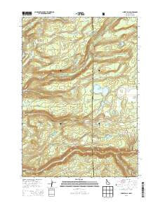
~ Sheep Falls ID topo map, 1:24000 scale, 7.5 X 7.5 Minute, Current, 2013
Sheep Falls, Idaho, USGS topographic map dated 2013.
Includes geographic coordinates (latitude and longitude). This topographic map is suitable for hiking, camping, and exploring, or framing it as a wall map.
Printed on-demand using high resolution imagery, on heavy weight and acid free paper, or alternatively on a variety of synthetic materials.
Topos available on paper, Waterproof, Poly, or Tyvek. Usually shipping rolled, unless combined with other folded maps in one order.
- Product Number: USGS-7753446
- Free digital map download (high-resolution, GeoPDF): Sheep Falls, Idaho (file size: 35 MB)
- Map Size: please refer to the dimensions of the GeoPDF map above
- Weight (paper map): ca. 55 grams
- Map Type: POD USGS Topographic Map
- Map Series: US Topo
- Map Verison: Current
- Cell ID: 40878
- Datum: North American Datum of 1983
- Map Projection: Transverse Mercator
- Map Cell Name: Sheep Falls
- Grid size: 7.5 X 7.5 Minute
- Date on map: 2013
- Map Scale: 1:24000
- Geographical region: Idaho, United States
Neighboring Maps:
All neighboring USGS topo maps are available for sale online at a variety of scales.
Spatial coverage:
Topo map Sheep Falls, Idaho, covers the geographical area associated the following places:
- Elk Point - Jackass Creek - Sheep Falls - Squirrel Meadows - Indian Lake - Paddy Lake - Buggy Spring - Bergman Reservoir - Lower Goose Lake - Winegar Creek - Dog Creek - Granite Creek Cow Camp - Middle Boone Creek - Widgit Lake - Chain Lakes - North Boone Creek - Coyote Creek - Steele Lake - Squirrel Meadows Guard Station - Bergman Lake Dam - Weaver Ranch - Putney Meadows - Indian Lake Dam - Upper Goose Lake - Thompson Hole - Ernest Lake - Steele Lake - Bergman Lake - Squirrel Meadows Forest Service Station - Indian Lake - Long Meadows - Swan Lake
- Map Area ID: AREA44.12544-111.125-111
- Northwest corner Lat/Long code: USGSNW44.125-111.125
- Northeast corner Lat/Long code: USGSNE44.125-111
- Southwest corner Lat/Long code: USGSSW44-111.125
- Southeast corner Lat/Long code: USGSSE44-111
- Northern map edge Latitude: 44.125
- Southern map edge Latitude: 44
- Western map edge Longitude: -111.125
- Eastern map edge Longitude: -111


